Natural Hazards in Germany
Natural event, natural hazard, disaster? The terms used to describe for example storms, earthquakes, floods are not always easy to classify. Following the different terms are described and an overview of the most frequent natural hazards in Germany is given.

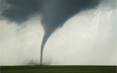
© Hermann/Jody Davis/David Mark Pixabay
Natural Hazards in Germany
Natural event, natural hazard, disaster? The terms used to describe for example storms, earthquakes, floods are not always easy to classify. Geophysical, meteorological, hydrological, or climatological processes such as these are initially described as natural events. If people and their valuables can potentially be affected by them, they are referred to as natural hazards (Dikau u. Voss, 2021). A volcanic eruption on an uninhabited island is therefore a natural event that initially poses no direct danger to humans. A volcanic eruption in a populated area would mean correspondingly high potential damage for people and valuable goods and is therefore to be described as a natural hazard.
If a natural event has occurred and (high) damage has been caused as a result, it is called a disaster. The term “natural disaster”, on the other hand, is misleading, as it gives the impression that nature alone triggers the disaster. However, humans are always part of the structure, as interactions between human actions and natural hazards influence what are actually natural events and, with regard to climate change, for example, are only intensified by human intervention (Dikau u. Voss, 2021). The DKKV avoids the term “natural disaster”, especially against the backdrop of disaster preparedness and raising awareness among the population.
Frequency and extent of damage
In a global comparison, Germany is rarely affected by disasters in the context of natural hazards (Marx et al., 2017). According to socio-economic considerations, the high population density in Germany is usually accompanied by an accumulation of values. As a result, natural events can result in a high economic loss (Münch, 2020). So, which natural hazards are specifically relevant for Germany?
EM-DAT
According to EM-DAT, According to EM-DAT, an international database for disasters, a total of 109 disasters related to natural hazards occurred in Germany in the period from 1990 to 2022. These are included in the database if at least one of the following criteria is met:
- Ten (10) or more people reported killed;
- Hundred (100) or more people reported affected;
- Declaration of a state of emergency;
- Call for international assistance.

Figure 1: Frequency (absolute and percentage) of disasters registered in EM-DAT for Germany in the period from 1990 to 2022 (left) and the associated fatalities (right). The database did not include Covid-19 or the 2021 flood disaster. Own representation. (Data source: EM-DAT, as of 30.01.2023)
The most frequent events recorded in Germany during this period were storms, followed by floods and extreme temperatures (Fig. 1, left). Epidemics, earthquakes, and avalanches are also included in the database, but occurred far less frequently. On the other hand, it is striking that the total number of recorded deaths (Fig. 1, right) is mainly in the category of extreme heat (90 %). The decisive factor here was the heat wave in the summer of 2003 with over 9,000 fatalities. It should be noted, however, that the devastating effects of the COVID-19 pandemic are not yet shown in this graph. The reasons and consequences show that epidemics/pandemics are also serious dangers that could occur more frequently in the future (IPBES, 2020). In addition to the frequency of natural events, the extent of damage is also relevant for the assessment of natural hazards. In the period from 1980 to 2017, Munich Re (Table 1) recorded total economic losses of €96.3bn in Germany caused by weather-related loss events (Munich Re, 2018).
Table 1: The 10 loss events with the highest overall economic loss in Germany from 1980 to 2017. Data source: Munich Re, NatCatSERVICE, 2017 in: Munich Re, 2018.
Date | Event | Affected area | Overall losses in Euro m* | Insured losses in EUR m* | Fatalities |
August 2002 | Floods, flash floods | Saxony, Dresden, Grimma, Torgau, Zwickau, Saxony-Anhalt, Magdeburg, Bitterfeld | 11.600 | 1.800 | 21 |
May to June 2013 | Floods | Bavaria, Passau, Deggendorf, Würzburg, Rosenheim, Baden-Württemberg, Saxony | 8.000 | 1.700 | 8 |
January 2007 | Winter Storm Kyrill | Entire country | 4.200 | 2.400 | 13 |
July 2013 | Hailstorms, severe storms | Baden-Württemberg, Reutlingen, Pforzheim, Lower Saxony, Wolfsburg, Hannover | 3.600 | 2.800 | |
May to Juny 2016 | Flash flood, severe storm | Baden-Württemberg, Reutlingen, Pforzheim, Lower Saxony, Wolfsburg, Hannover | 1.800 | 750 | 7 |
December 1999 | Winter Storm Lothar | Baden-Württember, Stuttgart, Reutlingen, Baden-Baden, Karlsruhe, Ansbach | 1.600 | 900 | 15 |
July 1984 | Hailstorm | Bavaria, esp. Munich, Passau, Landsberg, Altomünster, Freising, Ansbach | 1.500 | 750 | |
June - August 2003 | Heat wave, drought | Entire country | 1.500 | 10 | 9.000 |
October 2002 | Winter Storm Jeanett | North Rhine-Westphalia, Hamburg, Hesse, Schleswig-Holstein | 1.200 | 820 | 11 |
Mai/Juni 2008 | Severe Storm Hilal, haiil, flash floods | Baden-Württemberg, Hechingen, Zollernalbkreis, Neuried, Offenburg, Weinstadt | 1.100 | 800 | 3 |
Here, meteorological events (e.g., storms) accounted for the largest share with 61%. 33% of the total damage was due to hydrological events (floods and mass movements) and 6% was of climatological origin (e.g., heat waves). However, floods were increasingly responsible for the highest economic losses in the recent past (Marx et al., 2017).
Natural Hazards
From the perspective of both the frequency of disasters and the extent of damage caused by weather-related events, natural hazards in Germany are primarily storms and floods, but also extreme temperatures such as heat waves. These are briefly presented below; further information can be found on the corresponding topic pages.
Storms
Storms are caused by pressure differences and can be divided into winter storms and convective storms (Marx et al., 2017). Winter storms usually form over the North Atlantic, which is why northwest Germany is most frequently and severely affected by them. Convective storms, as a result of temperature fluctuations, can lead to heavy hail and mainly affect the south of Germany (Kreibich et al., 2014; Marx et al., 2017). They are spatially more limited, but occur much more frequently than winter storms, with 10 to 40 storm days per year (Marx et al., 2017). More information on the wind and storm topic page.
Floods
In Germany, floods include floods caused by heavy precipitation, river floods and torrents caused, for example, by snowmelt or heavy precipitation, as well as coastal floods after storm surges (Marx et al., 2017). In winter, river flooding can be triggered by dynamic low-pressure areas ’cyclones‘ in the west, with flooding mainly occurring in the catchment areas of the Rhine and the Weser, while the Danube in the south of Germany floods mainly in spring, due to snowmelt, and in summer, due to cyclones in the southwest (Beurton u. Thieken, 2009). Due to the combination of onshore winds and lower atmospheric pressure, storm surges on the North Sea and Baltic Sea occur mostly in the winter months (Marx et al., 2017). More information on the topic page Heavy rain.
Heat waves
Among the extreme temperatures, heat waves in particular will increase in intensity and frequency due to climate change, and may also favor droughts and forest fires (Meehl u. Tebaldi, 2004). A heat wave is usually defined as a period of five to seven days with temperatures above 30 °C (Kreibich et al., 2014). More information on the topic page about heat.
Earthquake
Earthquakes are far less prominent in their appearance, but due to the tectonic conditions in some regions of Germany they are certainly potential natural hazards. They occur as a result of seismic activity north of the Alps (Kreibich et al., 2014). Especially areas around the Upper Rhine Graben and the Lower Rhine Bay, which is mostly densely populated, are affected by this (Marx et al., 2017). Some of these areas are not only exposed to earthquakes due to their natural tectonic conditions, but also, for example, due to human activity in the form of mining (especially in the Ruhr area). Another area with increased seismicity is the Vogtland region in Saxony and Thuringia in eastern Germany (ibid.). More information on the topic page Earthquake.
Risk assessment through information portals
’Whether natural events turn into disasters depends on society’s vulnerability and preparedness‘ (Bittner et al., 2009: 7). A comprehensive discussion of possible events and the corresponding precautionary measures, such as building planning and insurance, is therefore not only advisable on a national level, but also on a personal level. Numerous information portals can be found online to assess potential dangers and risks in the living environment.
The CEDIM Risk Explorer of the Karlsruhe Institute of Technology (KIT) enables users to assess the risks posed by natural events in Germany. An interactive map shows how vulnerable the various regions are to winter storms, earthquakes, floods, and anthropogenic disasters. In combination with the vulnerability of the region, the resulting risks can be derived.
GIS – ImmoRisk by the Federal Institute for Research on Building, Urban Affairs and Spatial Development (BBSR) shows how the risk of winter storms, hailstorms, heavy rain, forest fires and heat waves will develop in the future due to climate change. This application is primarily intended to assess the risk to potential or existing property locations but can also be used by the general public for information purposes.
The current threat posed by floods can be determined by Pegel Online and the ”länderübergreifende Hochwasserportal“. Both services show current water levels for the whole of Germany and have comprehensive data sets that can be viewed for information.
The German Weather Service (DWD) also offers an overview of all current weather warnings in Germany on an interactive online map, as well as a warning weather app, which is also available in English, for direct personal warnings.

Figure 2: Natural hazard analysis– winter storms 1971-2000; GIS – ImmoRisk
The emergency information and news app of the federal government, warning app NINA, warns about various hazardous situations. In addition to weather warnings and flood warnings, it also provides information on, for example, the COVID-19 pandemic or the possible spread of hazardous substances.
All these services make it possible to get a good overview on the general and current hazard situation in Germany and to take precautionary measures if necessary.
Created: March 2023
Current Information
Tornadoes in Germany: New analyses show higher numbers of cases than previously assumed
New scientific analyses conducted with the participation of a group of experts from the German Weather Service (DWD) show that tornadoes occur more frequently in Germany than previously assumed. According to these analyses, an average of around 50 confirmed tornadoes...