Storms
In Germany, storms rank among the most frequent—and at the same time most consequential—natural hazards. Between 1990 and 2024, they accounted for approximately 59% of recorded disasters (EM-DAT 2024). This topic page provides an overview of the various types, origins, and impacts of storms.

© l.: pixabay | r.: unsplash
What are storms?
Storms are multifaceted natural phenomena that differ not only in their formation, but also in their intensity, spatial characteristics, and associated phenomena. They can be accompanied by lightning, thunder, heavy precipitation, flash floods, hail, snow, localized downdrafts, heavy gusts, tornadoes, or even storm surges and rough seas (Poljanšek et al. 2017, Catto, J.L. 2016), thereby underscoring their pronounced multi-hazard character (Lee et al. 2023). This diversity can sometimes make it difficult to identify risks at an early stage and assess them appropriately. Moreover, climate change influences the underlying conditions governing the formation and intensity of storms, and can further exacerbate their impacts (Huber 2021).
This thematic page provides a detailed overview of the various types of storms and their characteristic features. Furthermore, their impacts are categorized using the Beaufort scale, and the underlying processes of their formation are explained in an accessible manner. The aim is to foster a comprehensive understanding of the dangers posed by storms and to outline the preventive and protective measures that can be taken.

©unsplash
Types of Storms
Storm
A strong wind can be classified as a storm once it reaches wind speeds between 75 and 117 km/h. Even at these wind speeds, branches can snap, trees can be damaged, and initial damage to buildings can occur (DWD).
Thunderstorm
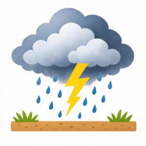
A thunderstorm is a localized convective storm that forms through the updraft of warm, moist air and is typically associated with cumulonimbus clouds, as well as lightning, thunder, hail, tornadoes, flash floods, and heavy precipitation (Poljanšek et al. 2017).

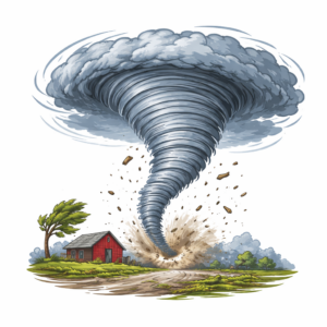
Tornado
A tornado occurs as an accompanying phenomenon of a thunderstorm and consists of a column of air rotating very tightly around its own axis. Powerful tornadoes form primarily within particularly intense, rotating thunderstorms known as supercells. Despite their comparatively small diameter, they can generate extreme wind speeds and cause massive destruction (DWD).
Extratropical storm
Extratropical storms are primarily driven by the spatial distribution of temperatures between the equator and the poles. A storm is defined as such when wind speeds exceed 75 km/h. (Mohr, S. n.d.).
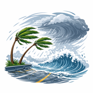
Tropical cyclone
Tropical cyclones are rotating, frontless vortices of air characterized by extremely low pressure at their center—the so-called “eye.” They form over warm ocean surfaces with water temperatures exceeding 26°C and attain hurricane-force wind speeds. Depending on the region, they are referred to by different names: as hurricanes in the Atlantic, typhoons in the Pacific, and cyclones in the Indian Ocean. Their diameter can range from 100 to 1,500 km (ARD 2024).
©AI-generated | DALL.E
Beaufort-Skala
Winter storms are classified based on their wind speed, as this is the primary factor determining their damage potential. The Beaufort scale provides a standardized classification system for extratropical storms, outlining the wind speeds at which specific impacts can be expected.
Table 1: Beaufort Scale | Source: DWD
BFT |
Description |
Windspeed in km/h |
Impact |
| 0 – 5 | Calm – Fresh breeze | 0 – 38 |
|
| 6 – 8 | Strong breeze – Gale, fresh gale | 39 – 74 |
|
| 9 | Storm | 75 – 88 |
|
| 10 | Strong storm | 89 – 102 |
|
| 11 | Violent storm | 103 – 117 |
|
| 12 | Hurricane force | From 118 |
|
Scales also exist for non-extratropical storms. The intensity of tropical cyclones is defined by the Saffir-Simpson Scale, which ranges from 119 to 252 km/h and classifies tropical cyclones into five categories (Shultz et al. 2005). There is also a separate scale for tornadoes, called the Fujita Scale (Dotzek et al. 2005).
How do storms form?
Storms arise from the interplay of rising air, air pressure differences, and dynamic processes within the atmosphere. In the case of large-scale storms—such as extratropical storms or tropical cyclones—the Coriolis force, caused by the Earth’s rotation, also plays a significant role. These processes constitute the physical basis for various types of storms, even though their specific conditions of formation differ markedly. Storms can be broadly categorized into small-scale (convectively driven) and large-scale (synoptically driven) events, although these two types of processes often interact.
Thunderstorms
Thunderstorms arise from convective processes, which are explained in simplified terms below. This occurs when rising warm, moist air condenses within an unstable atmosphere, leading to the formation of powerful thunderstorm clouds (cumulonimbus). Within these clouds, intense updrafts and downdrafts develop, giving rise to typical thunderstorm phenomena such as lightning, heavy rain, hail, and strong gusts (RoyalMeteorological Society 2020).
Convection
1.) Warming of the air
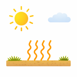
Solar radiation warms the ground and the moist air above it (Glaser et al. 2010).
2.) Rising of warm air
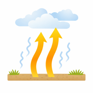
The warm, lighter air rises and transports moisture into higher atmospheric layers (Glaser et al. 2010).
©AI-generated | DALL.E
3.) Cooling and Cloud Formation
As air rises, it cools down, water vapor condenses, and massive cumulus clouds (e.g., cumulonimbus) form, from which thunderstorms can develop (Glaser et al. 2010).
Severe thunderstorms can also lead to the formation of tornadoes.
Tornadoes
Tornadoes usually develop within severe thunderstorms when strong vertical wind shear and temperature differences between air masses occur in addition to updrafts. Near the ground, small-scale rotating areas initially form, which then combine, intensify, and organize into a narrow vortex. This creates a rotating, tightly confined column of air that occurs mainly over land and is characterized by very strong, localized updrafts (DWD; Fischer et al. 2024).
Extratropical Storms
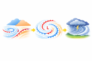
Extratropical storms in the mid-latitudes arise from the interplay of large-scale temperature differences and dynamic processes within the atmosphere. The starting point is the strong contrast between cold polar air and warm subtropical air along the polar front, which serves as the central energy source.
Dynamic processes occurring several kilometers up, particularly in the region of the jet stream, initially lead to the formation of a low-pressure system. Into this region, air converges near the ground, is deflected by the Coriolis force, and thereby sets in motion a rotating circulation, during the course of which warm and cold fronts form. Falling atmospheric pressure at the center and significant pressure gradients lead to increasing wind speeds, while processes at higher altitudes further amplify this intensification. Consequently, a severe storm system can develop, one that, in extreme cases, reaches hurricane force (Klose & Klose 2015).
©KI-Generiert | DALL.E
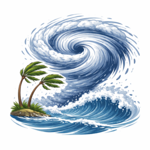
Tropical Cyclones
TTropical cyclones form over warm oceans between approximately 30° North and 30° South latitude, though not directly at the equator. Their development relies on the interplay between rising warm, moist air and large-scale atmospheric processes. Simply put, their formation can be explained as follows:
1. The Warm Ocean as an Energy Source
At sea surface temperatures of at least 26–27°C, a large amount of water evaporates, and the lowest layer of air becomes moist and warm.
2. Rising Air and Low-Pressure Formation
The warm air rises (convection), creating a low-pressure system at ground level.
3. Onset of Rotation
Due to the Earth’s rotation and the associated Coriolis force, the air system begins to rotate and forms a spiral structure.
4. Intensification of the Storm
Thunderstorm cells organize into a large, rotating storm system that draws in increasing amounts of warm, moist air, thereby growing stronger.
5. Forming of the eye
At the center, a relatively calm “eye” forms, surrounded by a zone of the strongest winds and heaviest precipitation.
Why are there no tropical cyclones at the equator?
Near the equator, the Coriolis force is too weak to induce any significant rotational movement in air masses. Consequently, storms with pronounced rotational motion do not form there.
The Coriolis force is also responsible for the fact that the rotational motion of cyclones proceeds counter-clockwise in the Northern Hemisphere and clockwise in the Southern Hemisphere (Shultz et al. 2005).

©AI-generated | DALL.E
Dangers Posed by Storms
The formation and characteristics of storms determine their intensity and impact. High wind speeds, flying debris, and associated phenomena, such as heavy rainfall or lightning, can cause significant damage and pose diverse risks to people, the environment, and infrastructure.
Uprooted Trees & Debris
Falling trees, falling branches, and flying objects are among the most common hazards and regularly lead to injuries, traffic disruptions, and property damage (DWD).
Damage to Buildings
High wind speeds can strip roofs, damage facades, and severely damage or destroy buildings (DWD).
Health
Storms can lead to injuries caused by debris or collapsing structures, and, in the worst-case scenario, result in fatalities. Furthermore, they can disrupt healthcare services and trigger psychological distress (Butsch et al. 2023).
Combination with Additional Hazards
If lightning, heavy rainfall, hail, or storm surges occur in addition, the resulting damage can be significantly exacerbated, causing storms to increasingly evolve into so-called multi-hazards (Lee et al. 2023).
Critical Infrastructure Failures
Storms can cause power outages, block transportation routes, and disrupt supply infrastructure (Butsch et al. 2023).
Perception
Storms are frequently underestimated—either because they occur regularly and thereby lose some of their perceived threat (Slovic 1987), or because they are rare and awareness of their potential danger is lacking. This can lead to risks being underestimated and protective measures being neglected.
How Storms Are Named
The naming of tropical cyclones in the Atlantic is clearly regulated at an international level. The National Hurricane Center in Miami is responsible for this process, utilizing fixed, rotating lists of names in which male and female names alternate. New storms are named sequentially from these lists to ensure unambiguous communication (National Hurricane Center).
In Europe, however, the naming of extratropical storms is significantly less standardized and varies from country to country. Moreover, in Germany, it is not the storms themselves that are named, but rather the associated high- and low-pressure systems. Since 1954, these have received their names from the Meteorological Institute of the Free University of Berlin (DWD). In this system, high- and low-pressure systems are assigned gender-specific names, with the allocation of male and female names alternating annually (Wetterpate).
As a general rule, including for tropical cyclones, the names of particularly destructive storms are not reused, as they are no longer considered appropriate (DWD).
Moreover, studies show that naming can influence perception: storms with female names tend to be perceived as less dangerous, a perception that, under certain circumstances, may also impact behavior in an emergency situation (Jung et al. 2014).
Climate Change
Due to human-caused climate change, the Earth has already warmed by approximately 1.1 °C compared to pre-industrial times (as of 2023). To avoid severe consequences, global warming should, according to the Paris Agreement, be limited to 1.5°C if possible. Without rapid emission reductions, increasingly severe extreme events such as heatwaves, droughts, storms, heavy rainfall, and floods are likely to occur (LpB).
In the context of climate change, changes are becoming apparent, particularly with regard to tropical cyclones. Due to the warming of ocean surfaces, the intensity of these storms is increasing above all.Studies show that for every degree of global warming, the proportion of particularly intense topical cyclones (categories 4 and 5) increases by approximately 25–30%, while weaker storms become less frequent (Holland & Bruyère 2014). Moreover, stronger storms are accompanied not only by higher wind speeds but frequently also by more intense precipitation, thereby increasing the risk of flooding (Knutson et al. 2021).
Furthermore, it is expected that tropical cyclones could shift further toward the poles in the future, potentially affecting regions that have previously had little experience with this type of storm (Studholme et al. 2022). For storms in the mid-latitudes, developments have so far been less clear, which is why reliable forecasts are still associated with uncertainties (Piatschek 2025). However, there are also trends toward more intense precipitation in the mid-latitudes, as you can read here on our page about heavy rainfall.
Dealing with Storms
Storms cannot be prevented or influenced. It is therefore all the more important to manage these natural events effectively in order to keep damage to a minimum. With the help of risk maps, weather observations, and numerical models, vulnerable regions can be identified and severe storms can often be predicted several days in advance. Therefore, it is important to monitor current warnings for instance, via the website of the Deutscher Wetterdienst and to take precautionary measures in a timely manner (Podbregar & Lohmann 2015).
The BBK therefore recommends the following measures:
Prevention
-
Regularly check for current weather warnings, for example, via warning apps (linked on the right) or weather services.
-
Secure loose outdoor objects, such as garden furniture, flowerpots, or trash cans, in advance to prevent them from becoming hazards during strong winds.
-
Regularly inspect roofs, windows, shutters, and other parts of buildings for possible damage or weak points.
-
If necessary, trim branches and trees near your home to prevent damage caused by falling branches.
-
Make basic emergency preparations, for example by keeping a supply of food and drinking water as well as a first aid kit.
-
Keep supplies ready for possible power outages, such as flashlights, batteries, or a battery-powered radio.
-
Keep important documents within easy reach and prepare a small emergency bag if necessary.
-
Check whether insurance against storm and severe weather damage for buildings and household contents would be advisable. (DKKV-topic page “Insurances in Risk Management”)
In Case of an Event
-
Follow current weather warnings and official instructions to stay informed about further developments.
-
Stay indoors as much as possible and avoid open areas, forests, and bodies of water.
-
Close windows, doors, and shutters, and secure objects that could be moved by strong gusts of wind.
-
During a storm, avoid trees, scaffolding, power lines, and loose parts of buildings, as falling branches or objects may pose a danger.
-
-
During thunderstorms, make sure to unplug electrical devices to prevent damage caused by lightning strikes.
-
Help other people if possible, without putting yourself in danger.
Aftercare
-
Continue to stay informed about current advisories and warnings, as further hazards may still exist.
-
Do not re-enter damaged buildings or areas until there is no longer any immediate danger.
-
Watch out for fallen branches, loose roof tiles, damaged power lines, or other potential hazards.
-
Avoid forests and parks, as trees weakened or damaged by the storm may still fall over.
-
Document damage to buildings or property, for example by taking photos, so that it can be reported later.
-
If necessary, assist with cleanup and relief efforts without putting yourself in danger.
-
Inform the responsible authorities about major damage or hazardous areas.
Emergency Apps
- NINA – Notfall-Informations- und Nachrichten-App: NINA provides nationwide alerts in Germany and, if necessary, location-based warnings about hazards such as floods and other major emergency situations. Warning information is compiled online at Warnung.bund.de.
- WarnWetter-App des DWD: Summarizes important information about the current warning and weather situation. Videos explain the situation. General warnings about thunderstorms, storm gusts, or heavy rainfall can be found on the website of the Deutscher Wetterdienst (DWD).
- KATWARN: The KATWARN app was developed by the Fraunhofer-Institut FOKUS on behalf of the public insurers and provides warnings and recommendations for action from authorized authorities and emergency organizations.
- Meteoalarm – Alerting Europe for Extreme Weather: The website provides warnings for Europe.
- KLiVO Portal: The Climate Preparedness Service supports the necessary adaptation to the impacts of climate change, for example through guidelines, tools, web portals, or climate data.
The BBK provides general preparedness measures and tips on how to behave in the event of a disaster here: Planning ahead for crises and disasters.
Additional information on how to behave during storms can also be found on the BBK website.
Aktuelle Informationen
Cyclone Gezani hits Madagascar hard – THW provides relief supplies
On 10 February 2026, tropical cyclone Gezani hit the east coast of Madagascar with wind speeds of up to 250 kilometres per hour, causing severe devastation. According to official reports, at least 31 people were killed and many more were injured. Several people are...
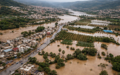
Series of winter storms causes severe flooding in North Africa and Southern Europe
A series of winter storms has caused severe flooding in Morocco, Spain and Portugal in recent days. People have lost their lives in several regions, hundreds of thousands have been forced to leave their homes, and the damage to infrastructure, agriculture and...


