

Landscape Fires
This page provides a comprehensive overview of landscape fires, their causes and consequences. It offers an insight into the practical challenges and introduces the key organisations involved in fire management and suppression of wildfires.
The content of this topic page was compiled by the Fire Ecology Research Group and the Global Fire Monitoring Center (GFMC), a joint institution of the Max Planck Institute for Chemistry and the University of Freiburg, associated with the Global Fire Management Hub.
© Unsplash
Landscape Fires and prescribed burning
Landscape fires are fires in the vegetation of natural and cultivated landscapes that can also spread to residential areas, industrial zones, and critical infrastructure (GFMC). Depending on the type of vegetation affected, in German colloquial language, in addition to the term “forest fire,” a fire in open terrain is referred to as a “Flächenbrand” or “vegetation fire”; this also includes, for example, grass and peat fires (BeSafeNet 2024). The term “Wildfeuer”, is borrowed from the English term “wildfire”, and is used for fires that burn unintentionally, unplanned, and out of control. In some ecosystems, such as savannas and deciduous forests in the subtropics or coniferous forests in northern latitudes, wildfires caused by lightning strikes are part of the natural ecosystem dynamics (GFMC). These vegetation types are adapted to regularly occurring wildfires. However, due to climate change, it is becoming apparent that wildfires in these changing ecosystems can increasingly cause long-term damages.
In cultural and industrial landscapes, wildfires can have a significant impact on public safety. During prolonged droughts, heat waves, and strong winds, wildfires can reach extreme sizes and spread at high speeds. In addition to the affected vegetation, agricultural lands, the outskirts of towns or industrial areas, and infrastructure—including critical infrastructure—can be impacted, as can land contaminated by human activity. These include both waste dumps and contaminated sites resulting from the application of chemicals such as herbicides, fetilizers or chemical accidents, as well as vegetation or soil contaminated with radioactivity (GFMC). Fires at such contaminated sites can lead to the co-burning and uncontrolled emission of combustion products containing these substances, which are hazardous to the environment and human health (GFMC).
Satellite sensors are detecting landscape fires worldwide with increasingly precise spatial and temporal resolution. While the media primarily classify fires detected by satellites as wildfires or forest fires, these recorded active fires also include controlled and rescribed burns in forests and on open lands—particularly on agricultural and pasture lands. These burning practices trace back to historical and, in some cases, even prehistoric land-use practices. However, if traditional practices—and, above all, those based on scientific evidence—are not followed, such land-use fires can get out of control and may cause damage. Today, however, these traditionally proven methods must increasingly be reevaluated, as the climate is changing rapidly and, with it, the conditions for prescribed burning. The increasing aridity of many landscapes may mean that historically proven practices should no longer be used in the future.
Landscape Fires Worldwide, in Europe, and in Germany
The largest proportion of global wildfires—both in terms of number and area affected—occur in grasslands, savannas, and other open landscapes, particularly in Africa and Australia, as well as in South Asia and South America. Approximately 20% of these fires are wildfires and fires set in forest ecosystems for land-use change (BeSafeNet 2024). These relative and, above all, absolute figures are based on the analysis of satellite-based remote sensing data and vary over the years. Various portals operated by public and private institutions provide access to real-time data and data archives (GFMC Remote Sensing Portal). While landscape fires (excluding agricultural burnings) covered an annual average of approximately 680 million hectares (ha) (6.8 million square kilometers) during the last two decades of the 20th century, this figure has decreased in recent years: In 2025, the figure was approximately 335 million ha (GFMC Global Landscape Fire Damage Reports).
However, statistics for the European Union show an increase of area burned in recent years. In particular, more than 1 million ha of landscape fires were recorded in 2025 (EFFIS 2026) (Fig. 1).
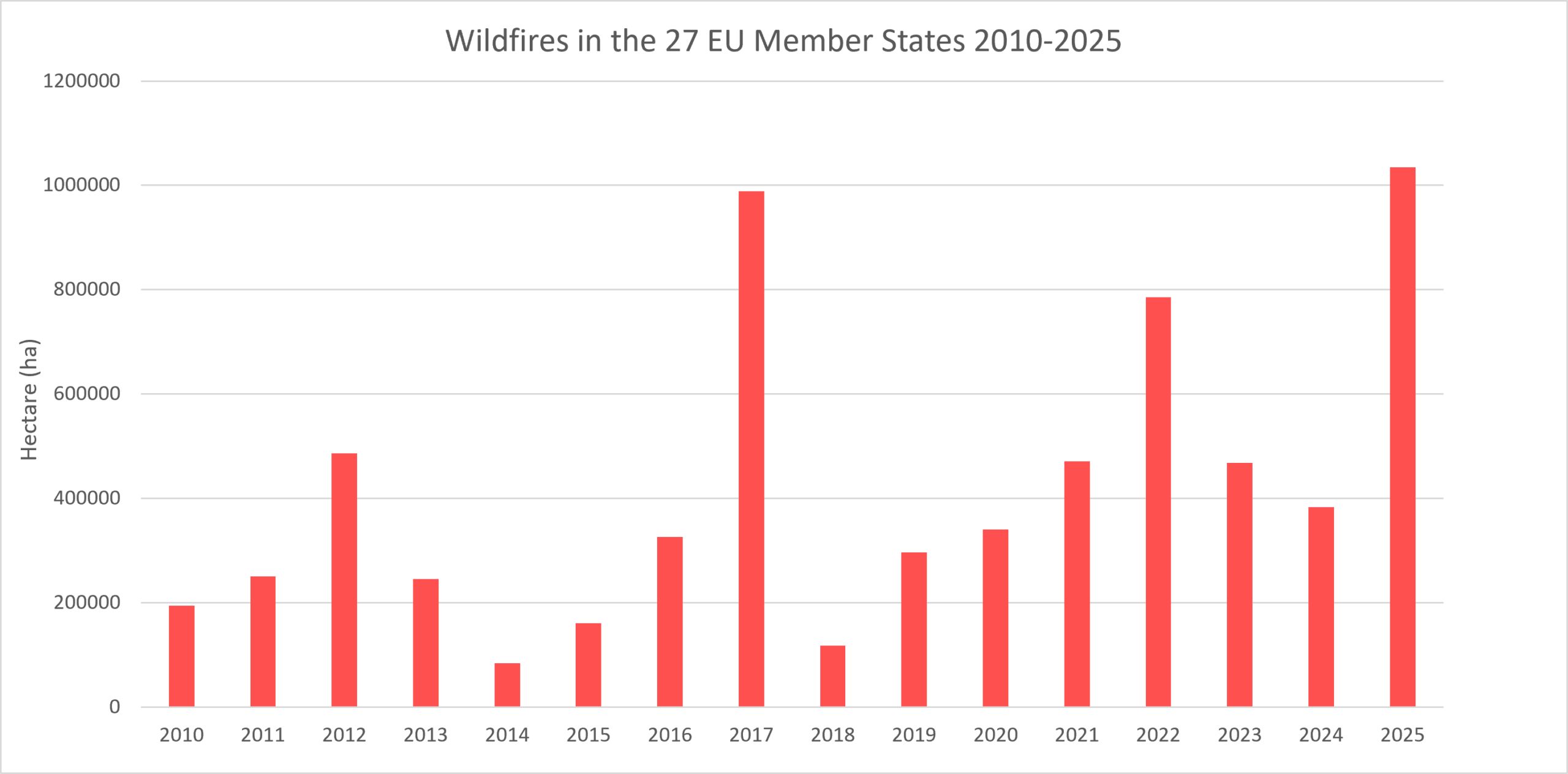
Fig. 1. Wildfires in the 27 EU Member States, 2010–2025 (EFFIS 2026).
Wildfires are also becoming an increasing challenge in Germany. The approximately 11.4 million hectares of forest—which account for about 30% of Germany’s total land area—are increasingly at risk from fires, particularly due to the rise in prolonged dry spells and heat waves caused by the climate crisis. In addition to forests, open landscapes such as heathlands and dried-out wetlands are also affected by fires, which have a significant impact on biodiversity. In Germany, too, the causes of wildfires are diverse. About 96% of fires are caused by humans, with negligence and arson being the main causes.
In Germany, statistical data is collected exclusively for forested areas. The Federal Office for Agriculture and Food (BLE) evaluates the annual reports from the states and the federal government (BLE Forest Fire Statistics). Data is available for this period from the 1970s through 2025. Looking back over the last two decades, there has been an increase in the number of affected forest stands since 2018 (Fig. 2). However, these figures may also include individual non-forest areas, such as the reported forest fire areas in Gohrischheide in 2025. Approximately one-quarter of the recorded burned areas consist of non-forest areas.
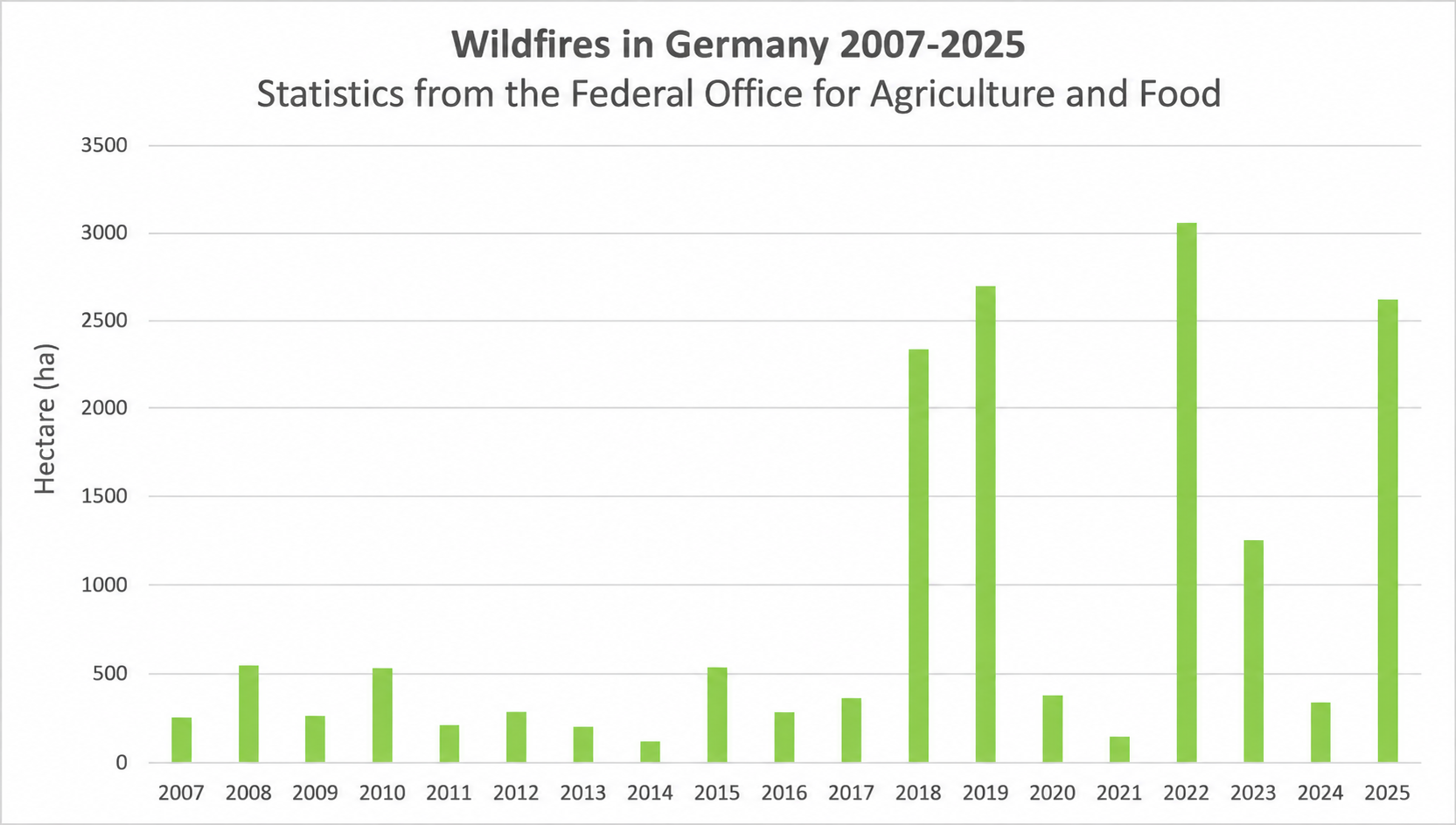
Fig. 2. Wildfires in Germany, 2007–2025 (BLE 2026)
Since the extent of fires in open areas (all vegetation types outside forested areas, including nature reserves) and on agricultural land is not statistically recorded, satellite data can be analyzed as an alternative (EFFIS 2026; Our World in Data 2026). To date, this data has not been available with the same level of accuracy as the forest fire areas measured on the ground, since, for example, EFFIS only accounts for fires larger than 30 ha. Consequently, in countries where many forest fires on areas smaller than 30 ha are brought under control, this satellite data provides an incomplete picture. However, they do reveal the magnitude of open-land fires, which in some years far exceed the area of forest fires (Figs. 3 and 4).
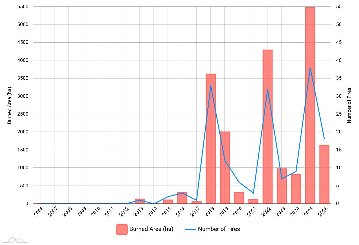
Fig. 3. Fire areas in all landscape types in Germany recorded by EFFIS from 2013 to 2026 (including June 2026). EFFIS records only fires larger than 30 ha. As a result, the predominantly small fires in forested areas are not included—however, fires in open land are included in these figures (EFFIS 2026).
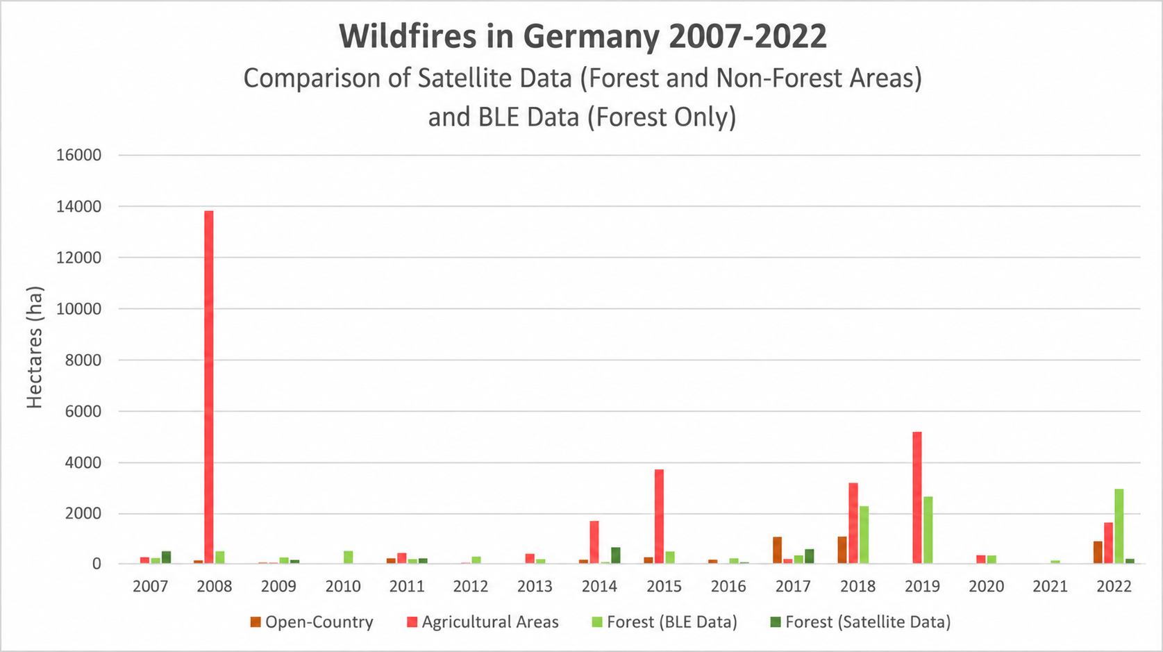
Fig. 4. Areas of open country affected by fires in Germany from 2007 to 2022, based on various Earth observation systems and compared with forest fire data from the BLE. These data also show that, in some years, open-country fires in Germany are more extensive than forest fires (Our World in Data 2026).
Although deciduous forests—especially beech forests—were historically considered less susceptible to fire than coniferous forests, they are now increasingly at risk of fire due to drought damage (GFMC / G20-Bericht Bundesrepublik Deutschland 2023) (Fig. 5).
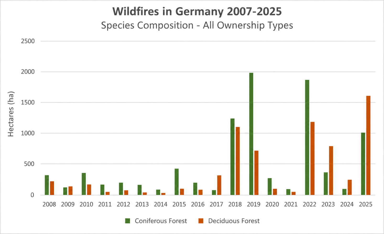
Fig. 5. Forest fires in Germany, 2007–2025, by forest type (coniferous forests / deciduous forests) (BLE 2026)
While “nature-based forest management” aims to promote biodiversity and carbon sequestration, the increasing accumulation of deadwood and limited accessibility to protected forests have led to fires of greater intensity and severity, as seen in Saxon Switzerland National Park and Harz National Park in 2022. During and after the 2022 fire season, these fires sparked a public debate—at times a contentious one—regarding the assessment and mitigation of wildfire risk through the abandonment of sustainable forest management practices, limited access to forests, and the retention of deadwood (GFMC 2023).
Conditions: Drought and Heat Wave
Due to climate change, large-scale weather patterns have been occurring with increasing frequency in recent years, bringing warm and dry air masses from North Africa across Southwestern Europe to Central Europe—and with them, heat waves and prolonged drought. Persistent high-pressure systems block the West Wind Draft and thus prevent low-pressure systems carrying precipitation from moving in (DWD 2026).
The drying out of soils in forests and open lands and the decline in the water table are counterbalanced by observations of forest vitality in Germany. In annual nationwide forest condition surveys, the condition of the tree canopy leaves is monitored through a network of sample plots as an important indicator of their vitality. As a result of the dry years of 2018–2020, the most recent survey in 2025 also revealed persistently high levels of crown thinning across many tree species and age classes (Thünen Institute of Forest Ecosystems 2026). Only about 21% of all trees surveyed in Germany’s forests show no crown damage (BMLEH 2026). The combination of more frequent and longer periods of dry and hot weather patterns, reduced soil moisture, increased canopy openness, and a higher proportion of deadwood (Fig. 6) results in an increased risk of high-intensity and severe wildfires in some forest areas of Germany.
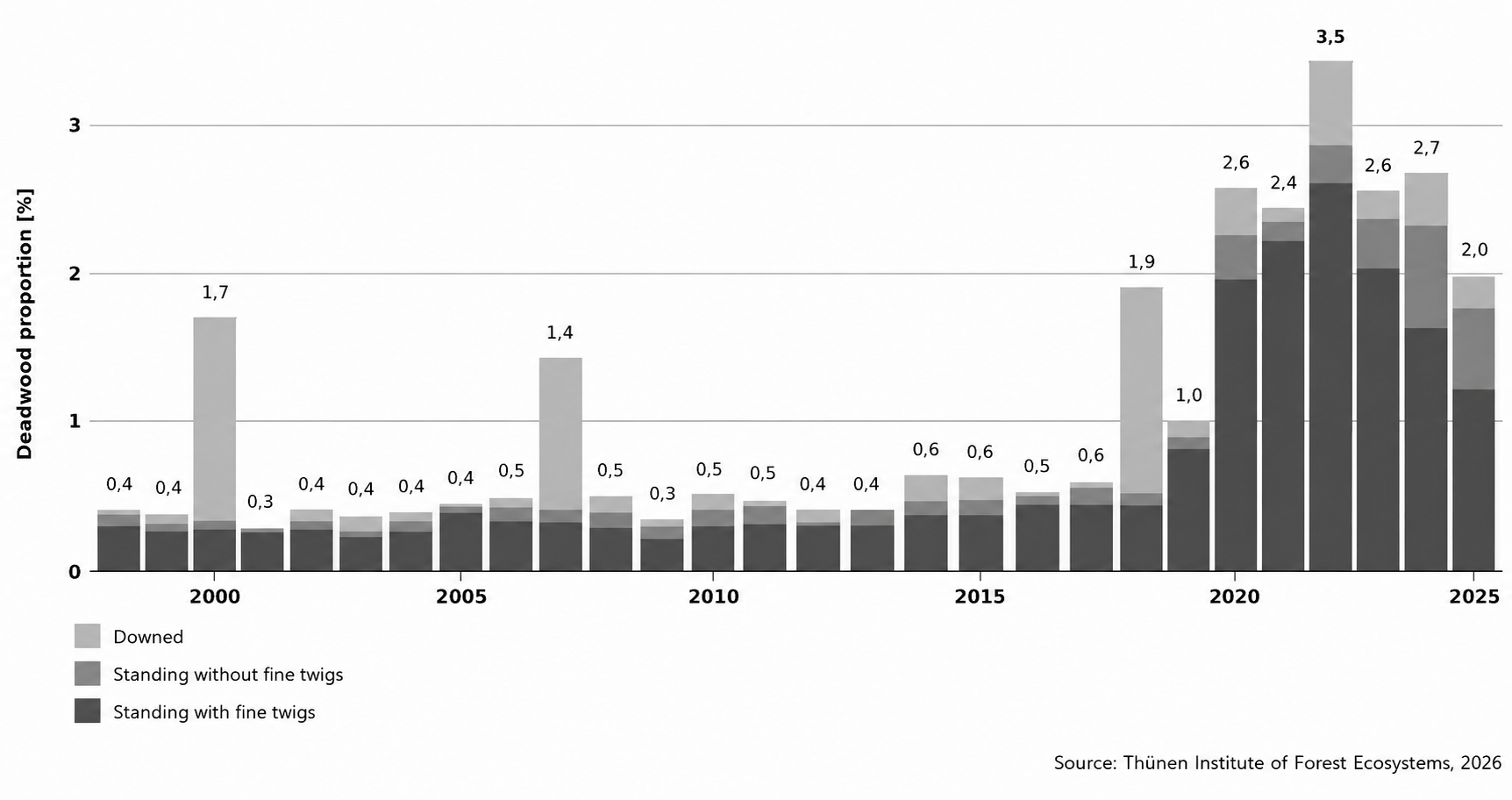
Fig. 6. One of the findings of the 2025 nationwide forest condition survey: Trends in deadwood proportions since 1998, broken down by subcategories (Thünen Institute of Forest Ecosystems 2026)
The risk and spread of wildfires can be determined through meteorological forecasts. Many countries use early warning systems that generate wildfire danger indices based on weather data (including temperature, humidity, and wind), terrain characteristics (such as slope and aspect), and fuel properties (e.g., moisture content of grass, litter, and dead wood) (BeSafeNet 2024). Various wildfire danger indices are used worldwide to accurately assess the risk of wildfires.
Fire Weather Index (FWI)
The FWI is a numerical measure of fire intensity and is used as a general index of fire danger in Canada’s forested areas (Canadian Forest Fire Danger Rating System). It is based on noon readings of air temperature, relative humidity, and wind speed, as well as the amount of precipitation accumulated over a 24-hour period.
Wildfire Danger Index (WBI)
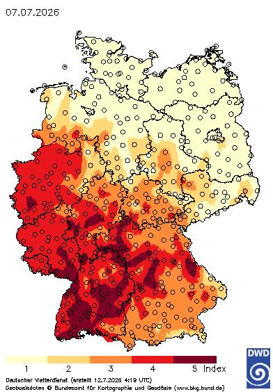
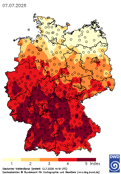
The German Weather Service’s Forest Fire Danger Index (WBI), which is modeled after the Canadian Fire Weather Index (FWI) and incorporates concepts from the German Baumgartner and M68 indices, calculates fire intensity based on factors such as litter moisture, soil moisture, and wind speed (DWD). The WBI uses hourly data on temperature, humidity, wind speed, and precipitation to determine the wildfire risk and rates the meteorological potential for wildfires on a five-level scale ranging from 1 = very low risk to 5 = very high risk. The index is updated daily; however, local deviations from the WBI forecasts are possible (DWD – WBI). The DWD has also developed the Grassland Fire Index (GLFI), which assesses the fire risk of open, unshaded terrain with dead wild grass and no green undergrowth (DWD – GFLI).
Direct Damage and Other Consequences
According to Germany’s wildfire statistics, the damage to forest stands recorded by the federal and state governments averages €1.9 million annually for the years 1991 through 2025 and approximately €4.4 million for 2025 (BLE Waldbrandstatistik). Damage assessments from fires on agricultural land and in adjacent settlements are not systematically recorded—though individual examples indicate significant damage. The costs of firefighting are also not recorded systematcally. The costs primarily include compensation for lost wages paid by employers or to self-employed members of volunteer fire departments, which are reimbursed by the municipality or the fire department’s agency in accordance with state regulations. These costs are not statistically tracked at the national level; according to GFMC estimates, they can exceed millions of Euros in cases of major fires.
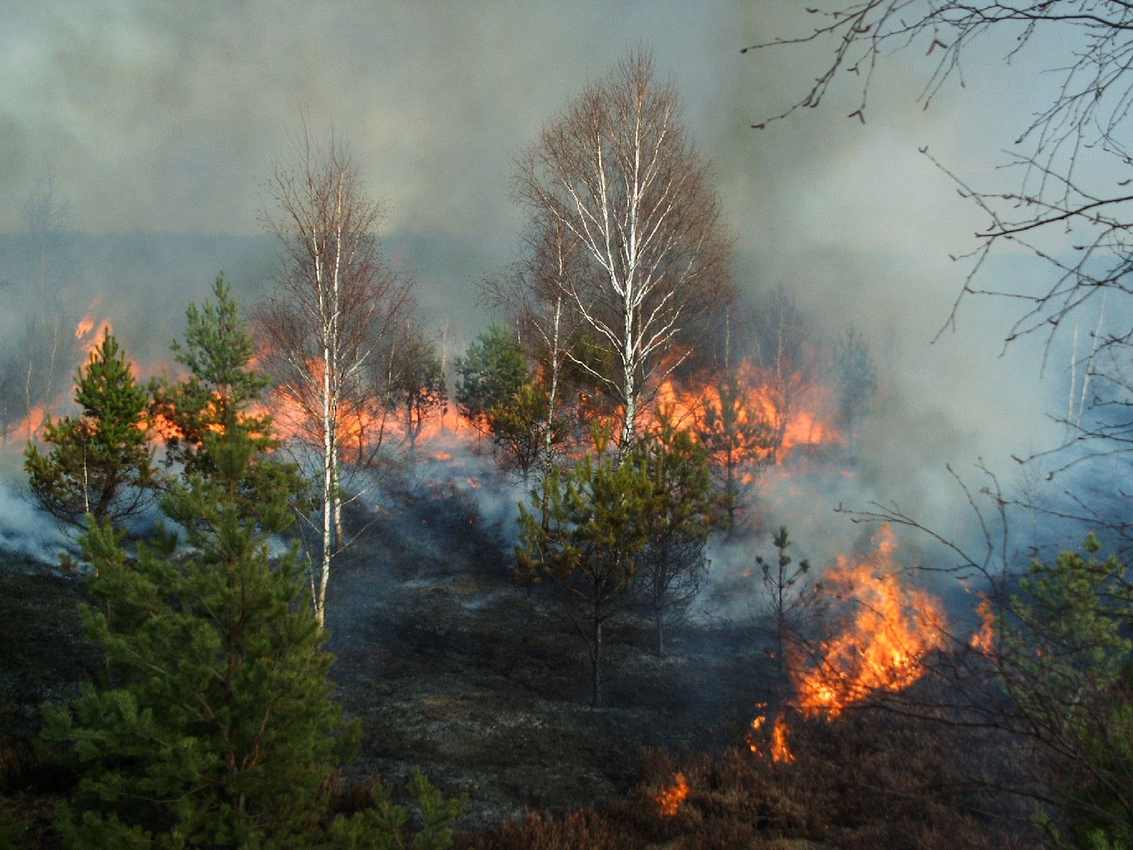
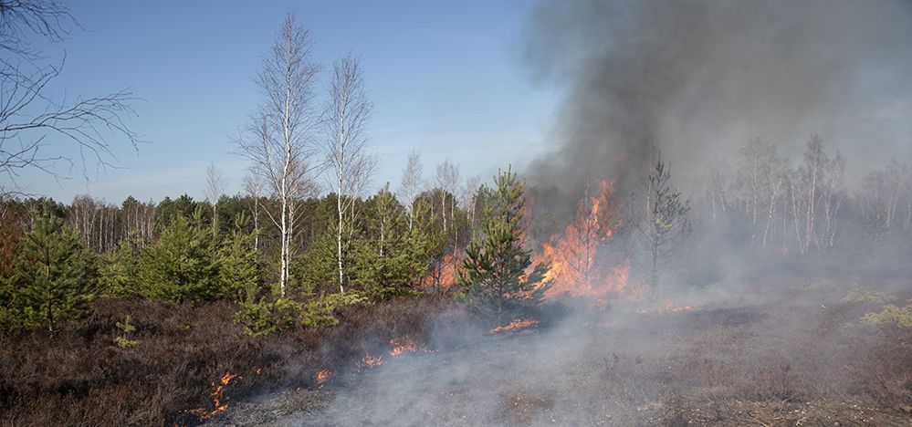
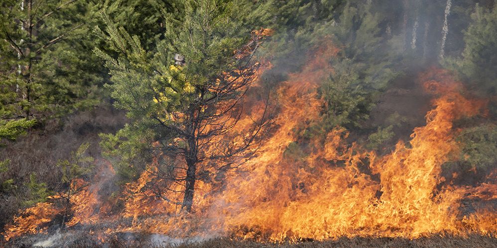
Fig. 8. Fire in a young mixed stand of pine and birch
Damage Caused by Wildfires in Germany – Examples
- Lower Saxony (August 1975): 8,000 ha of forest and approximately 5,000 ha of marshland, heathland, and agricultural land; 15,000 firefighters and 11,000 Bundeswehr soldiers deployed; 7 fatalities. Inflation-adjusted damages to the destroyed forest areas as well as other direct property damages: €60–80 million.
- German Democratic Republic (GDR) (1976): 2,480 fires covering a total of 5,900 ha of forest; economic damage approximately 13 million marks.
- Saxony (2022): Forest fire in the Saxon Switzerland National Park covering 115 ha (neighboring forest area in the Czech Republic also affected: 1,031 ha); economic damages of approximately €3 million and response costs of approximately €10 million.
Damage Caused by Agricultural Fires and Fires Along the Outskirts of Towns—Examples
- Siegburg (North Rhine-Westphalia) (August 2018): A fire on a embankment along the railroad tracks damaged or destroyed 8 homes—32 people were injured—and 100 residents were affected.
- Groß Miltzow, Rekentin, and Nienhagen (Mecklenburg-Western Pomerania) (July 2021): Several agricutural fires destroyed grain fields, a combine harvester, and a fire truck; two people injured – damage estimated at approximately €0.5 million.
- Falkenberg (Brandenburg) (July 2022): A fire in a mixed field-and-forest area spreads to a pig farm—500 pigs killed, 700 residents of the villages of Rehfeld and Kölsa evacuated, 7 emergency responders injured.
- Altenreuth (Bavaria) (June 2023): A grass fire spreads to a farm: Two barns, a stable, and a garage completely destroyed; a residential house significantly damaged—damages approx. €0.5 million.
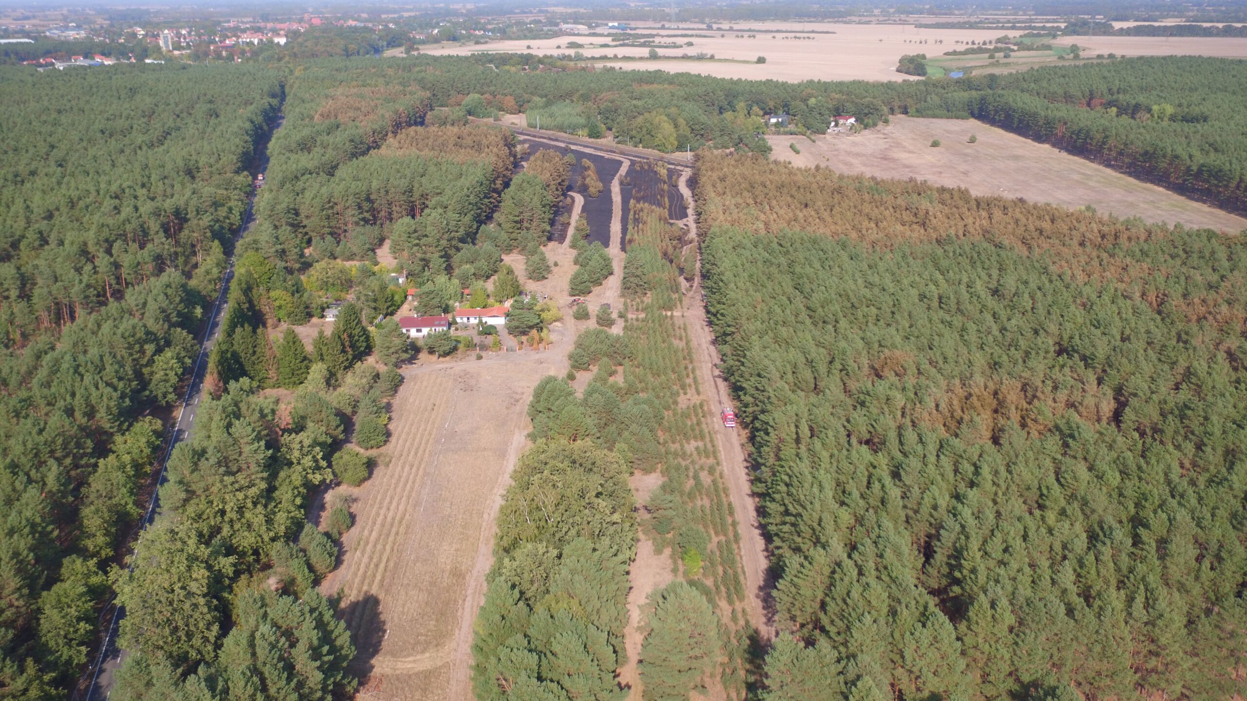
Fig. 9. A fire spreading through a mixed landscape of forest, fields, and farmsteads
The effects of wildfires extend beyond the ecosystems of natural and cultural landscapes to include biogeochemical cycles and, consequently, the climate-relevant composition of the atmosphere (Fig. 7). The degradation of ecosystems that were originally rich in biomass into impoverished sites, caused by fire and climate change, results in the release of carbon into the atmosphere or its sequestration in soils and sediments. Particularly problematic for the destruction of ecosystems and the disruption of local, regional, and global climates is the conversion of natural forest ecosystems and wetlands through clearing, drainage, and the subsequent burning of plant biomass. This conversion to other land uses—such as agro-industrial plantations or pastureland—not only leads to significant losses of biodiversity but also to the release of carbon previously stored in terrestrial ecosystems into the atmosphere. For example, a tropical rainforest can store between 300 and 700 metric tons of carbon in its trees, other vegetation, and soil. After “forest burning” and conversion to pastureland in the tropics, only 50 to 150 metric tons remain stored—the difference then mathematically contributes to an increase in the anthropogenic greenhouse effect. However, if, for example, forests are allowed to regenerate naturally or are reforested after a wildfire and restored to their original state over the course of the forest ecosystem’s life cycle, the carbon that was previously emitted is sequestered again (DIE ZEIT 2021).
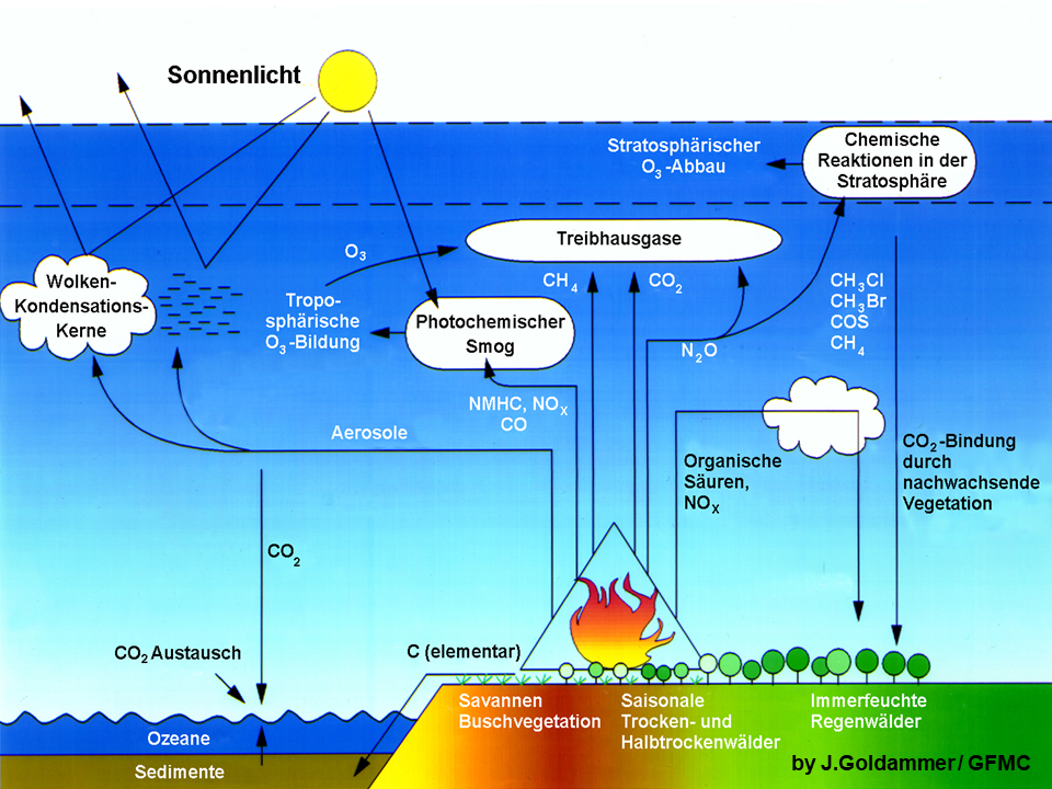
Fig. 10. Emissions from wildfires affect the composition of the atmosphere. Some trace gases contribute to the greenhouse effect. In contrast, aerosols reflect incoming solar energy and thus have a cooling effect (GFMC 1991).
Additional Impacts and Damage—Worldwide
Smoke from wildfires also has a significant impact on public health, as it contains gaseous compounds and particles that can exacerbate respiratory diseases and cause long-term health risks such as cancer (BeSafeNet 2024). Children, older adults, and people with viral infections are particularly at risk (Federal Environment Agency 2023; WHO; WMO / GFMC). Estimates of premature deaths worldwide caused by smoke exposure from wildfires range from 100,000 to 350,000 per year (GFMC Global Landscape Fire Damages Reports).
Global Damage Caused by Wildfires
The GFMC’s annual damage assessments show the following losses for 2025 (GFMC Global Landscape Fire Damages Report 2025):
Fatalities
- 31 first responders (27 ground personnel, 4 aircraft crew members)
- 135 civilians (comparison with previous years – 2024: 413; 2023: 332; 2022: 240; 2021: 162; 2020: 622; 2019: 253; 2018: 365; 2017: 303; 2016: 127) and 34 missing persons
Injured
- 316 emergency responders
- 91 civilians
Evacuations
- 839 individuals
- 700 families
- 178 residential buildings
Residential buildings
- 767 destroyed private residential buildings
- 860 damaged private residential buildings
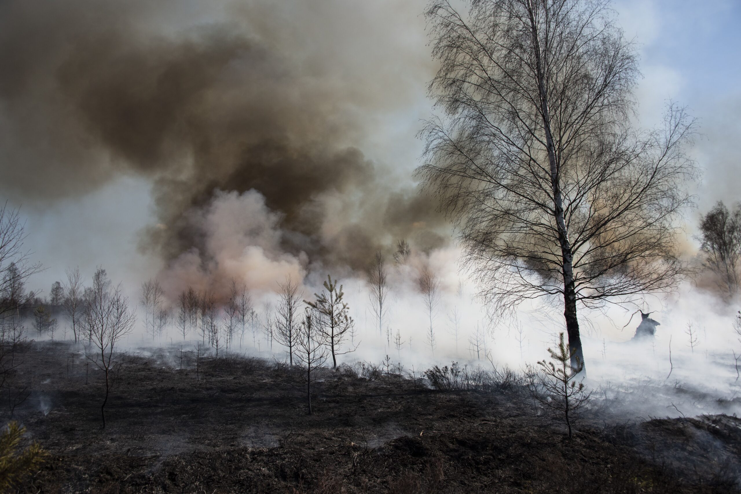
Fig. 11. If safety precautions are not followed, smoke exposure poses a health hazard—and can even be fatal—to emergency responders and the affected population.
A large proportion of the buildings in urban areas and suburban settings in North America and Australia that are set ablaze by fire jumping over or flying embers from wildfires are not or only partially surrounded by vegetation.. The spread of building fires in inner-city areas is therefore an urban problem of structural fire vulnerability (GFMC / DKKV, GFMC/SMC). The losses reported by insurers and reinsurers primarily involve insured wooden buildings in industrialized countries. One example is the fires within the urban area of Los Angeles, which, according to estimates by Munich Re, caused a total of $US 53 billion in damages, including $US 40 billion in insured losses (Munich Re 2026).
Research for Practical Application
The basic research in fire ecology initiated at the University of Freiburg in 1974 led to the establishment of the Fire Ecology Research Group in 1979, which increasingly focused on application-oriented issues in the 1980s and 1990s, primarily on the introduction of prescribed burning in nature conservation (GFMC 2014) and the transfer of fire ecology and fire management knowledge into practice (GFMC 2025). Following the research group’s transition to the Max Planck Institute for Chemistry in 1990, the Global Fire Monitoring Center (GFMC) was established, which is dedicated to researching the regional and global impacts of wildfires and transferring this knowledge to policy and practice, i.e., serving the Science-Policy-Practiceners Interface (SPPI) ( (Fire Ecology Research Group, GFMC, GFMC-Conferences). Starting in 2020, numerous time-limited research projects were launched in Germany at various universities and other research institutions. In particular, 22 research and modeling projects were funded by the Forest Climate Fund, which is jointly financed by the Federal Ministry of Agriculture, Food, and Home Affairs (BMLEH) and the Federal Ministry for the Environment, Climate Action, Nature Conservation, and Nuclear Safety (BMUKN) (FNR 2020).
Applying research to practice
After reunification, the experience gained in preventing and combating wildfires in both parts of Germany was largely forgotten. The reasons for this lay in changes in forestry and agriculture, in public administration, and in the reduced priority given to disaster and civil protection following the end of the Cold War. With the visible onset of the climate crisis in 2018 and the apparent increased vulnerability of natural and cultural landscapes to fires, opportunities have arisen to incorporate insights from research and technological development into a new approach by governmental and nongovernmental actors. Key areas of action include, among others:
- Increasing the resilience of nature conservation, forestry, and agriculture: Identifying and resolving conflicts arising from the climate-driven increase of wildfires risk and the need to conserve or promote biodiversity and carbon sequestration in forests and open lands. To this end, concepts are being developed to spatially design the landscape with regard to fire risk in such a way that various ecosystem services are protected or promoted, while at the same time reducing the risk of large-scale, hard-to-control fires spreading—for example, through wildfire protection corridors (GFMC / SMC 2022, DKKV / GFMC 2022).
- Firefighting: Responsibility for fighting wildfires lies with the 294 counties and more than 11,000 municipalities, which have a total of 23,700 volunteer fire departments that, along with the approximately 100 professional fire departments, bear the brunt of the work. The training and equipment of fire departments benefit from the experiences of Euro-Mediterranean countries and the recommendations of national model projects.
- Fire management as a cross-sectoral task: In addition to the key stakeholders in forestry and agriculture and in fire and disaster protection, local governments and civil society as a whole must also play a role (GFMC 2021, GFMC 2026).
Guide to Training in Wildfire Suppression
Recommendations for training in wildland fire suppression from the Training and Tactics Subworking Group of the Federal-State Open Working Group on National Wildfire Protection (application and implementation are the responsibility of the federal states):
Training Modules of the Forest Fire – Climate – Resilience (WKR) project
- Module 1: Introduction to Fire Behavior (2021)
- Module 2: Fire and Weather (2022)
- Module 3: Operational Tactics(2023)
- Module 4: Wildfires – Post-fire Operations (November 2022)
- Module 5: Tools and Equipment (2024)
Joint Technical Recommendation from NGOs (@fire, WBT, SKV)
Additional International Training Materials
- EuroFire Competency Standards and Training Materials (GFMC; in 23 languages)
- GFMC portal with access to additional international guidelines and training materials
Additional Online Resources
- Collection of Articles on Wildfires (Waldwissen.net 2016)
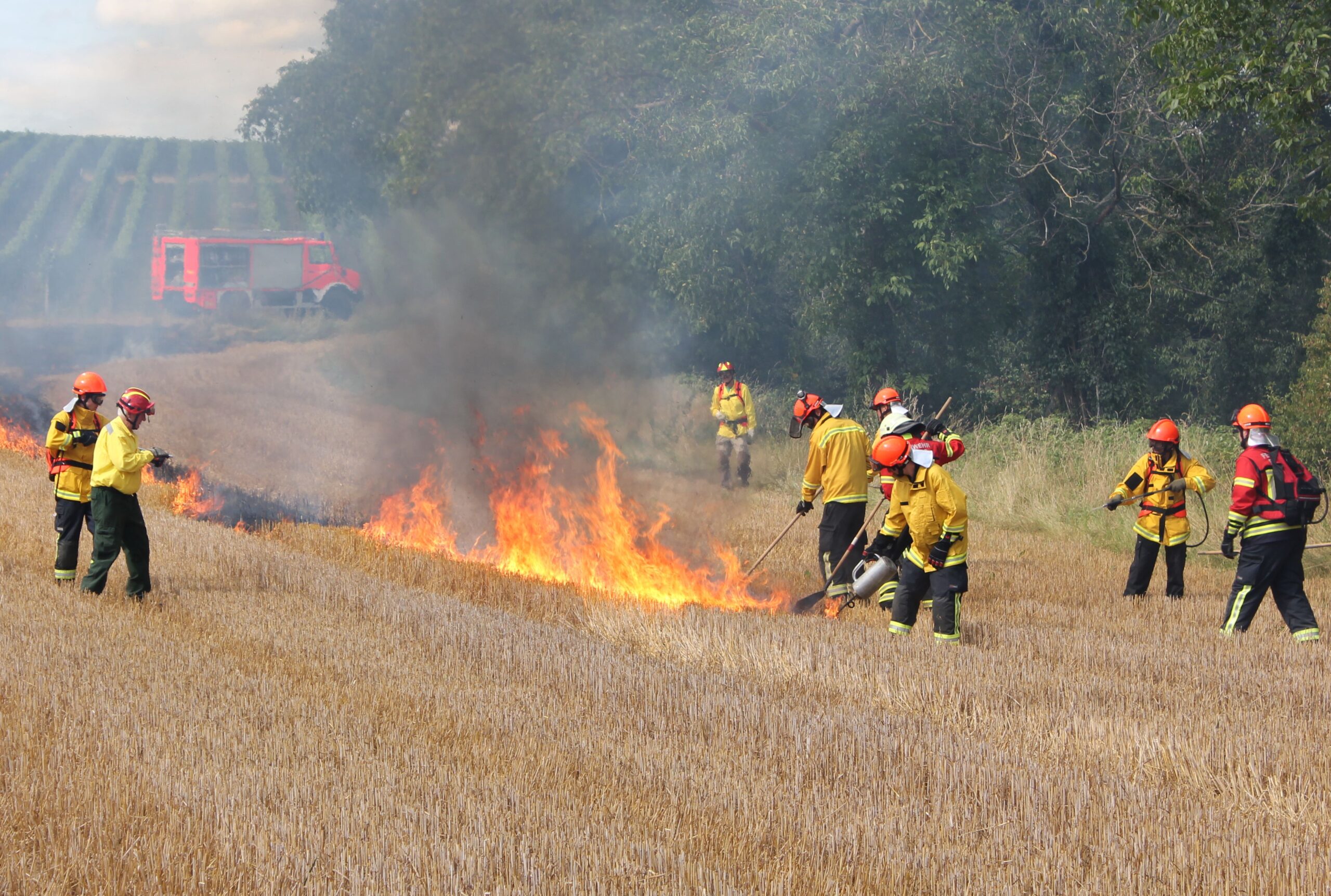
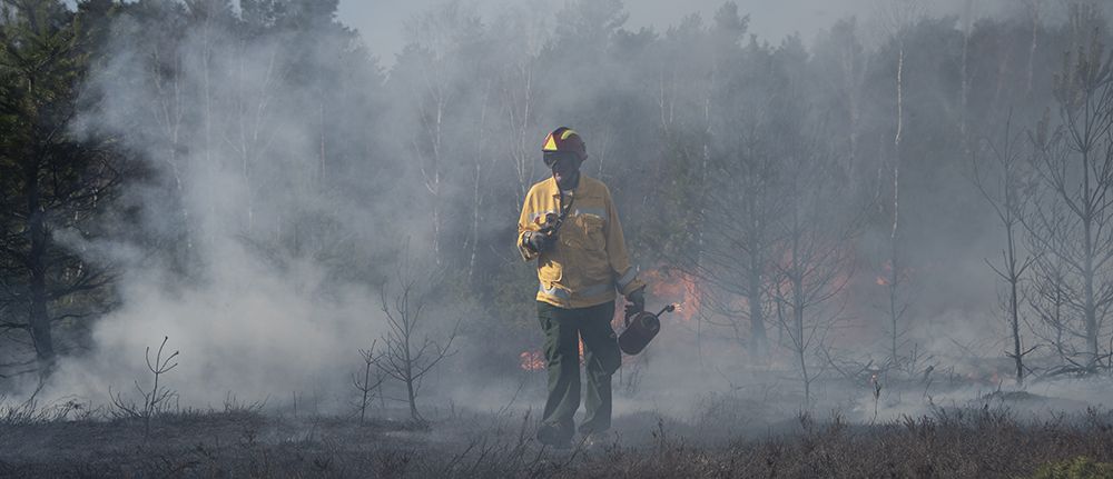
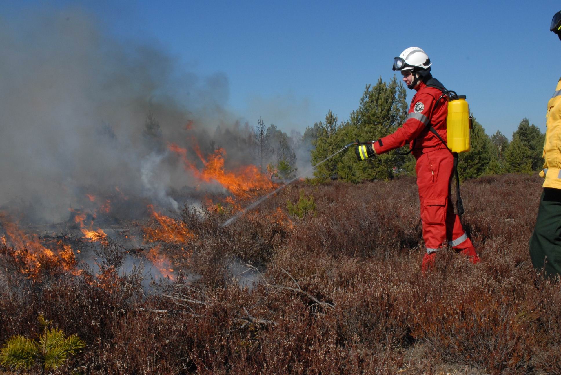
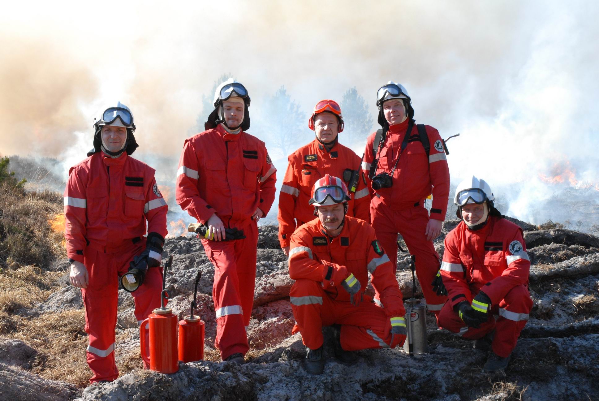
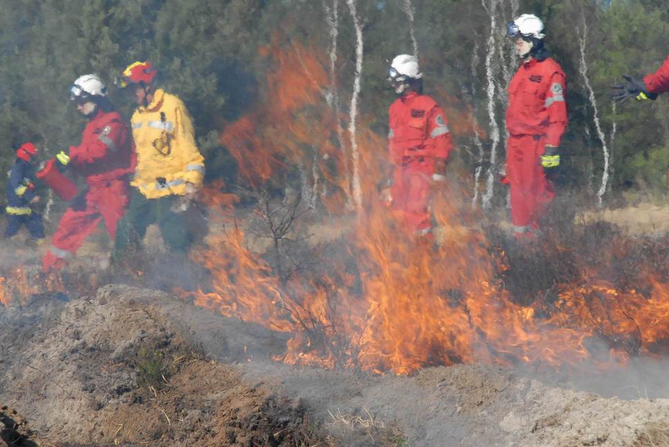
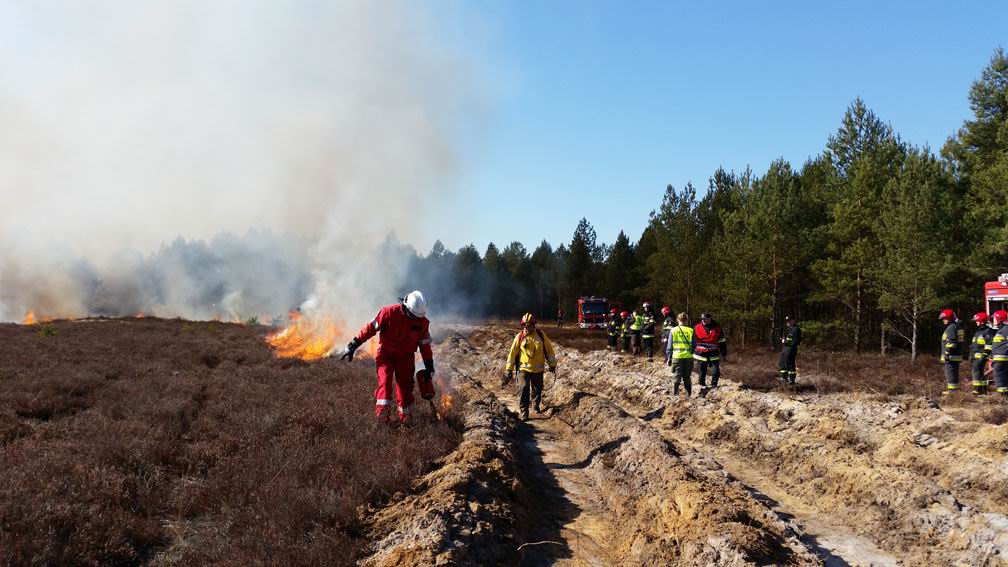
Training for the Wildland Fire Task Force in Freiburg includes repeated practice with hand-held equipment and suppression firing (backfiring).
Examples of the Implementation of Integrated Models at the Local Level
In addition to forestry authorities and fire departments, other municipal agencies—such as local governments, public works departments, agricultural offices, public transportation agencies, public health services, the police, and the German Armed Forces—play key roles in inter-agency cooperation within municipalities. Two examples at the local level:
The City of Freiburg im Breisgau (Baden-Württemberg) Model
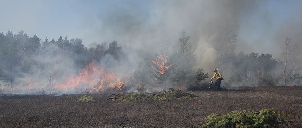
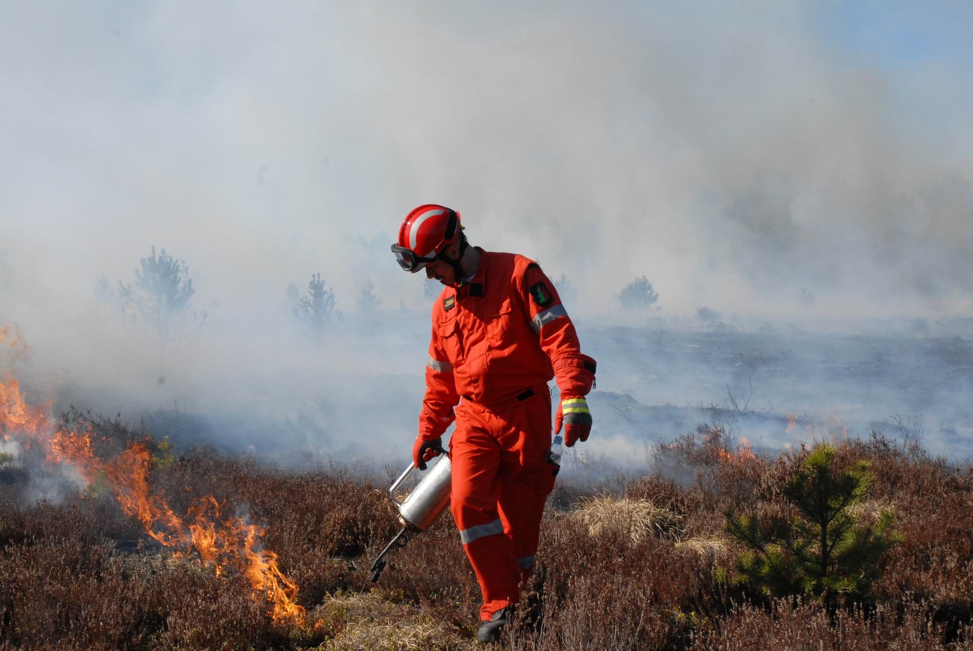
Beginning in 2012, the city of Freiburg has been developing an integrated, interagency approach to preventing and combating wildfires. To this end, in addition to the Wildfire Task Force—comprising two units of the volunteer fire department—forestry personnel were also specially trained and equipped. The task force, which uses hand-held equipment including for drip torches for suppression firing and can also be deployed in terrain inaccessible to vehicles, proved particularly effective during the forest fires of 2020 and 2022.
Case Study: The City of Beelitz (Brandenburg)
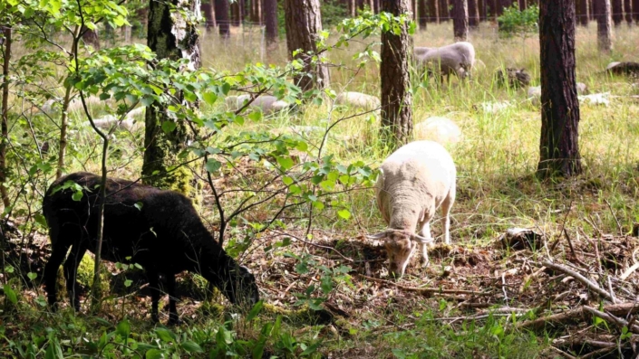
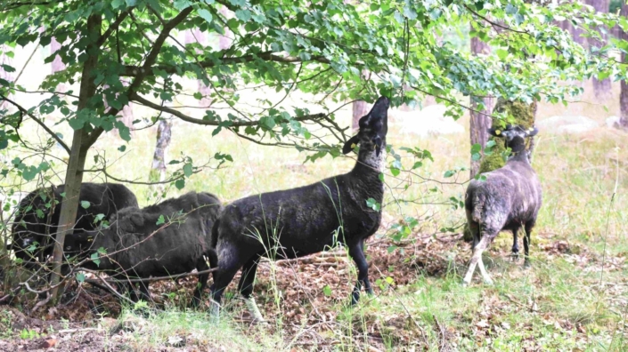
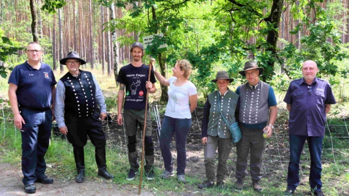
Following the fires that threatened the Fichtenwalde district and the northern areas of Beelitz in 2018 and 2022—and which also necessitated evacuations in 2022—the city administration took measures to protect the itnerface between residential structures and the forest by establishing wildfire protection corridors, in which highly flammable material is removed and the ground vegetation and shrub layer kept low through prescribed grazing
- City of Beelitz Wildfire Website
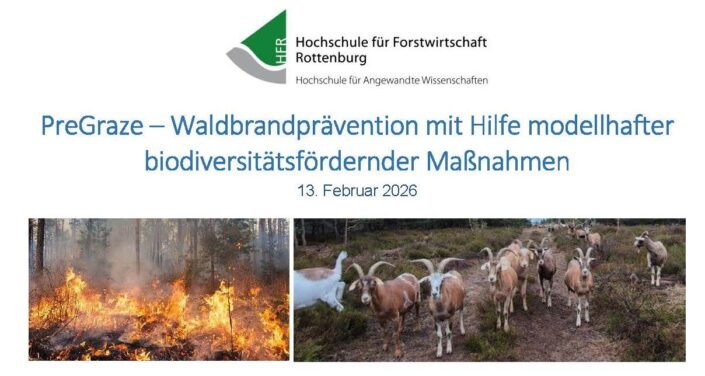
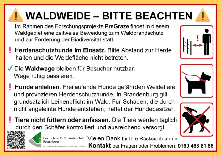
- PreGraze – Wildfire Prevention Through Exemplary Biodiversity-Promoting Measures
Additional Online Resources
- International Guidelines for Protecting Rural Settlements Against Wildfires(Defence of Villages, Farms and Other Rural Assets against Wildfires: Guidelines for Rural Populations, Local Communities and Municipality Leaders) (in six languages)
- Wildfire website for use in schools and civil society (Council of Europe’s “Natural Hazards” website – BeSafeNet) with recommendations on self-help measures for preparedness and risk reduction
- EIS GEGEN HEISS – ICE AGAINST HEAT – How We Must Adapt to the Consequences of Climate Change (Excerpt featuring the chapter on wildfires) (Kiepenheuer & Witsch 2025)
- Climate Change, Extreme Weather, Forests, and Wildfires: A Cross-Sectoral Challenge (Emergency Preparedness 2021)
- Climate Change, Forests, and Wildfires—A New Reality (Local Government Journal 2022)
Prescribed Burning—Focus on Nature Conservation and Unexploded Ordnance
The use of fire in open areas and forests is largely restricted or prohibited by the Federal Nature Conservation Act and, in greater detail, by state laws and regulations (state laws and regulations concerning nature conservation, pollution control, forests, and waste disposal). However, exceptions are possible when the use of prescribed burns to preserve habitats of high conservation value is in the public interest, is authorized or carried out by the authorities, and is compatible with the objectives of nature conservation and landscape management (GFMC 2004). Experience in Germany (GFMC 2009, GFMC 2014) and in Central and Northern Europe demonstrates extensive experience and success in the application of science-based methods (GFMC 2010).
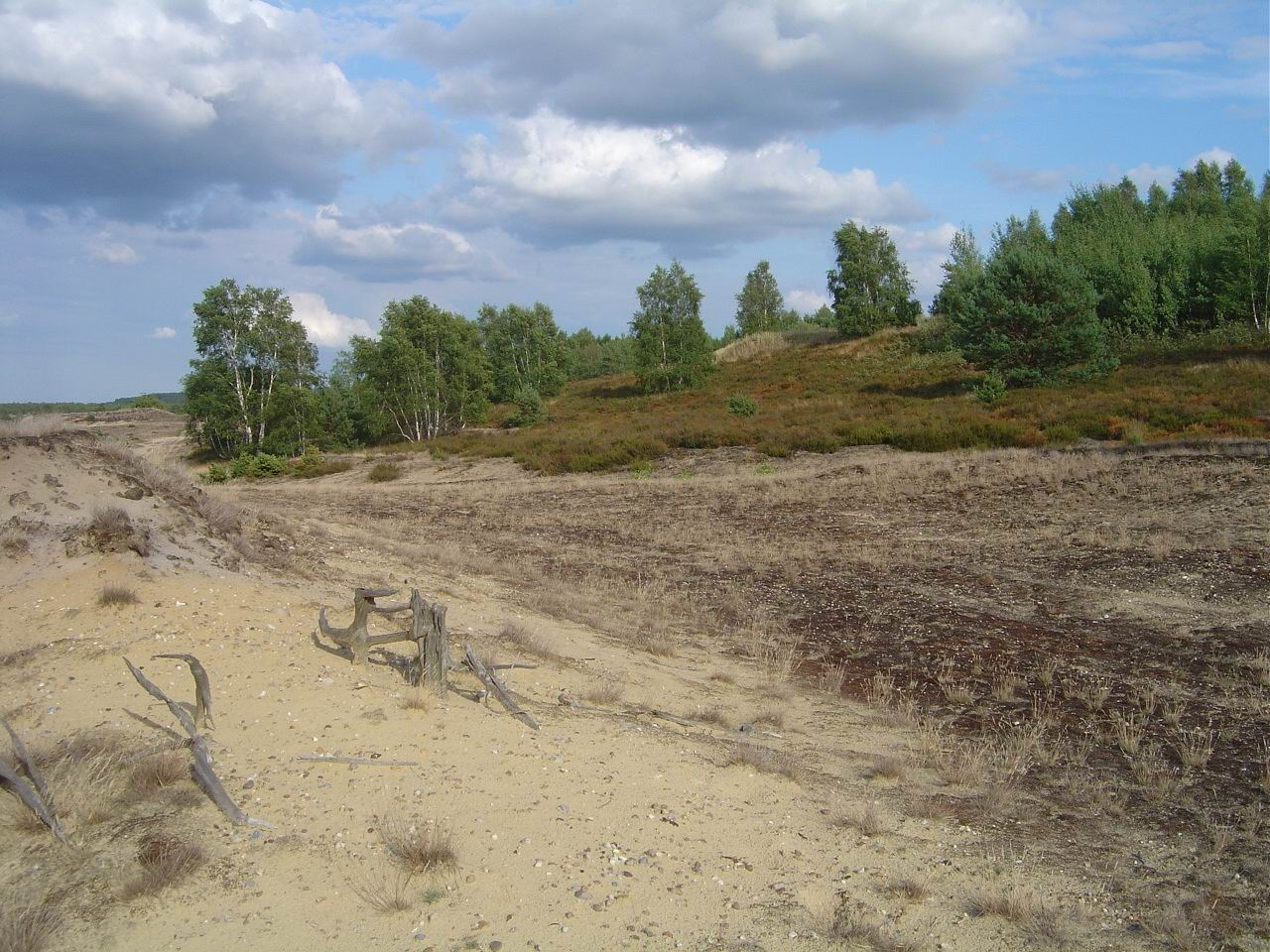
Fig. 12. Species-rich dwarf shrub heaths and inland dunes on former military sites are prone to tree invasion in the absence of mechanical disturbances or fire.
This primarily affects the approximately 680,000 ha of active and former military training and firing ranges—representing just under 2% of Germany’s total land area. Of this, 646,000 hectares are relevant from a nature conservation perspective, and 316,000 hectares are classified as FFH areas – of which up to 250,000 hectares are contaminated with munitions(unexploded ordanance – UXO) (David Nature Foundation). On many training grounds, “ecological disturbances”—primarily caused by vehicles, shelling, and fires resulting from military use—have led to the development of open-land habitats that are valuable from a nature conservation perspective. These include, for example, species-rich heathlands and sandy nutrient-poor grasslands, which were once widespread but have been increasingly displaced by intensive land use and have found their last refuges on land used for military purposes.
Based on a research and development project, a method was developed between 2006 and 2014 that enables the use of prescribed burning to preserve threatened dwarf shrub heathlands on sites contaminated with UXO and, at the same time, to clear such ordnance in the long term using safe technology (GFMC). This method is not being implemented in the federal states, meaning that fires at these sites remain difficult to control. This is particularly the case when, as part of the biodiversity strategy, wilderness areas are designated at these sites, in which case explosive ordnance can no longer be cleared. Since the biodiversity strategy also calls for the preservation of biodiversity tied to the cultural landscape, the conservation value of open-land ecosystems should continue to be prioritized (see also the David Nature Foundation).
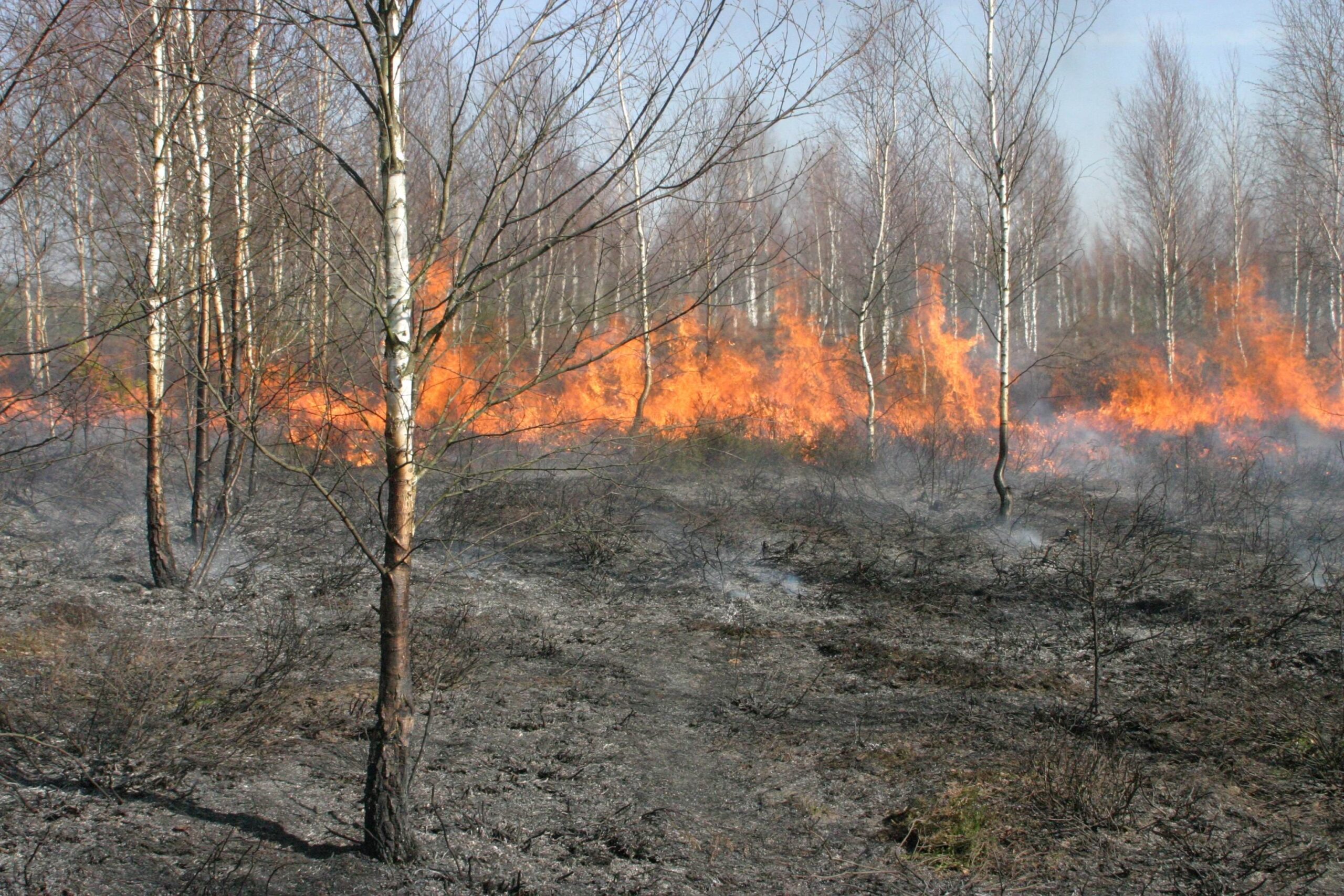
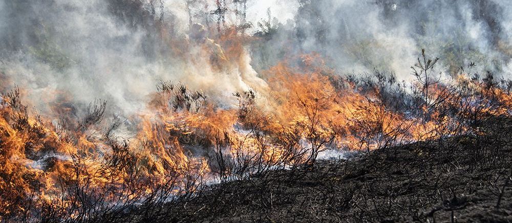
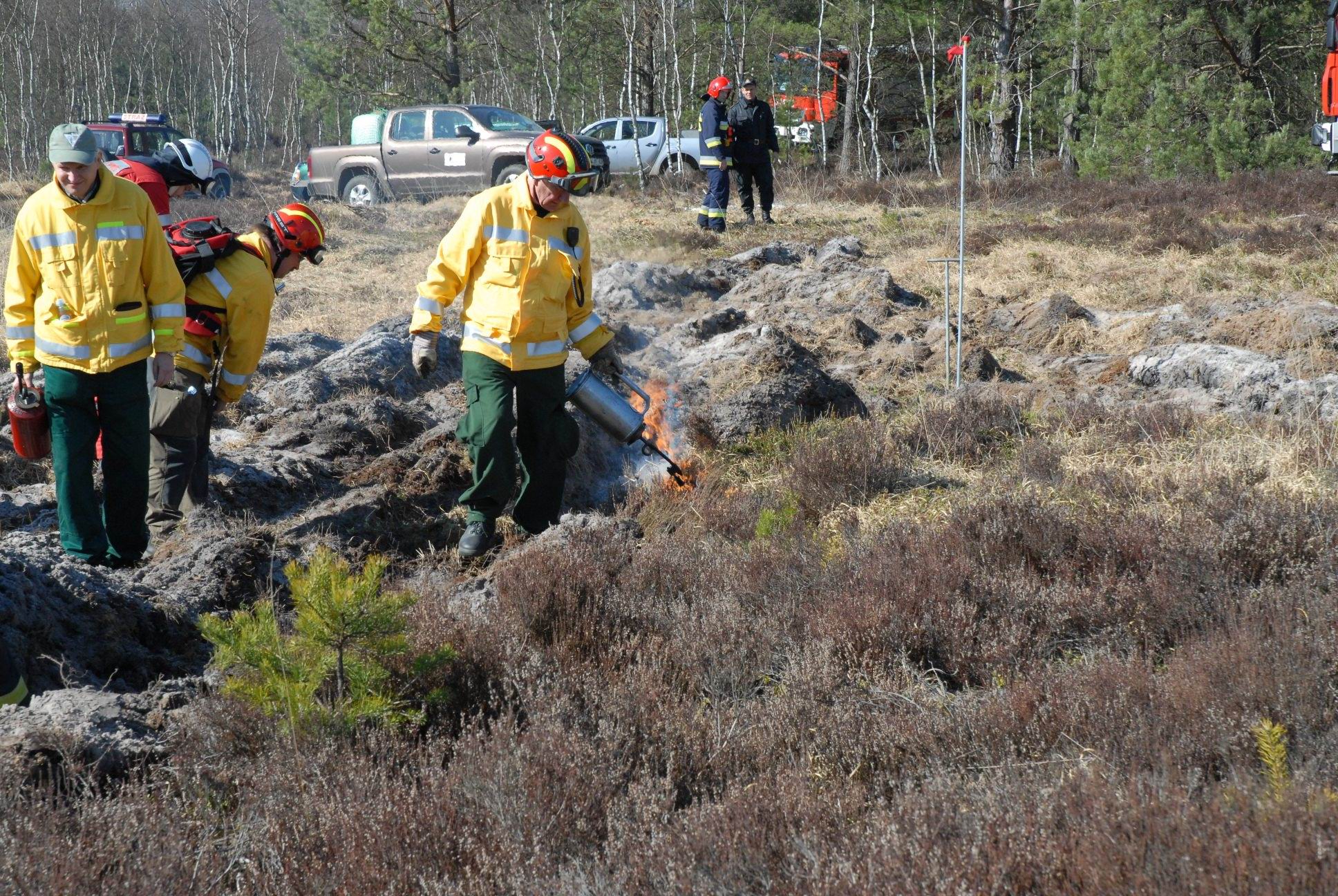
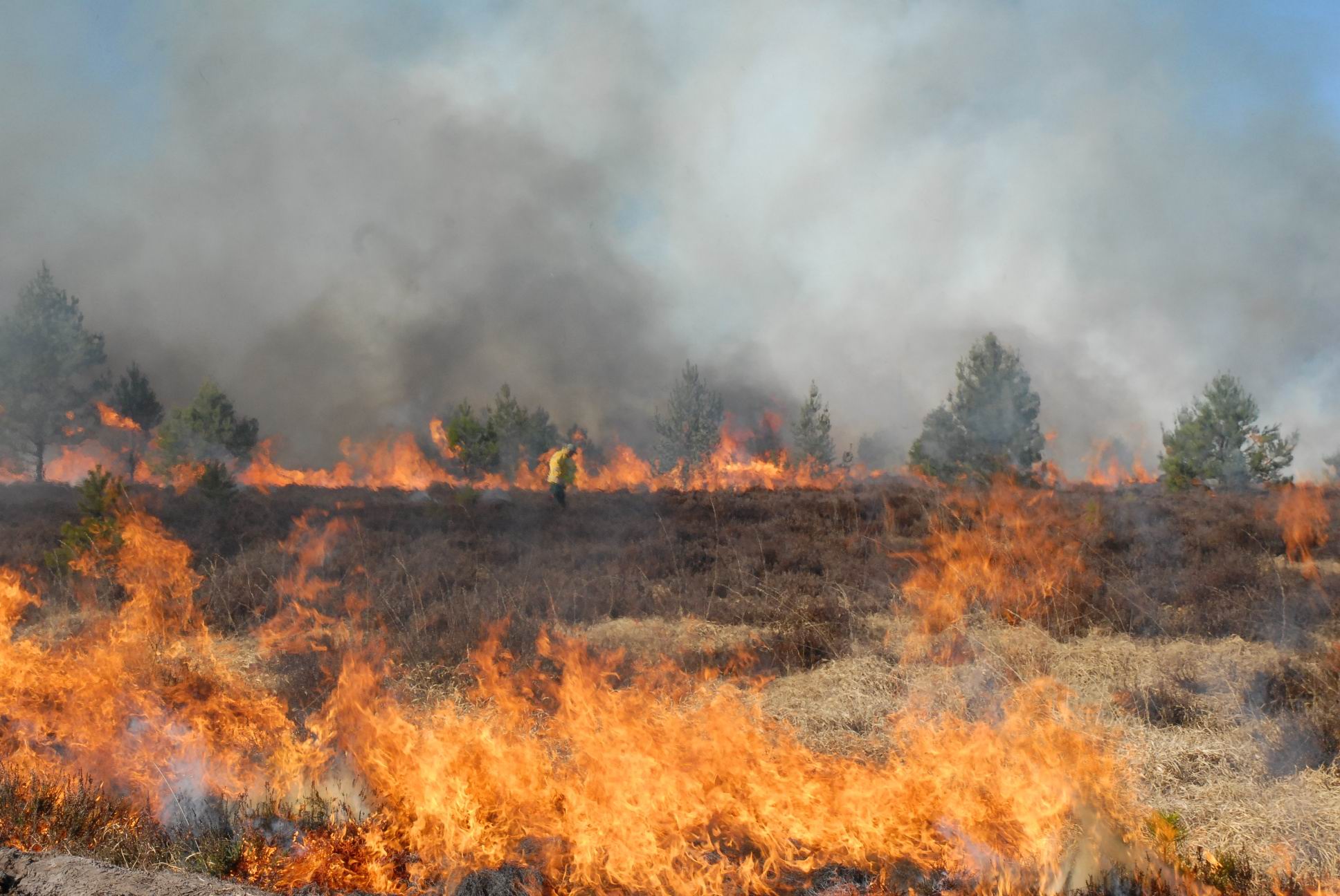
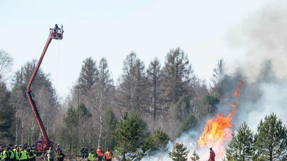
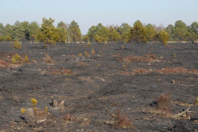
Fig. 13. Controlled burning to preserve dwarf shrub heaths by suppressing reforestation
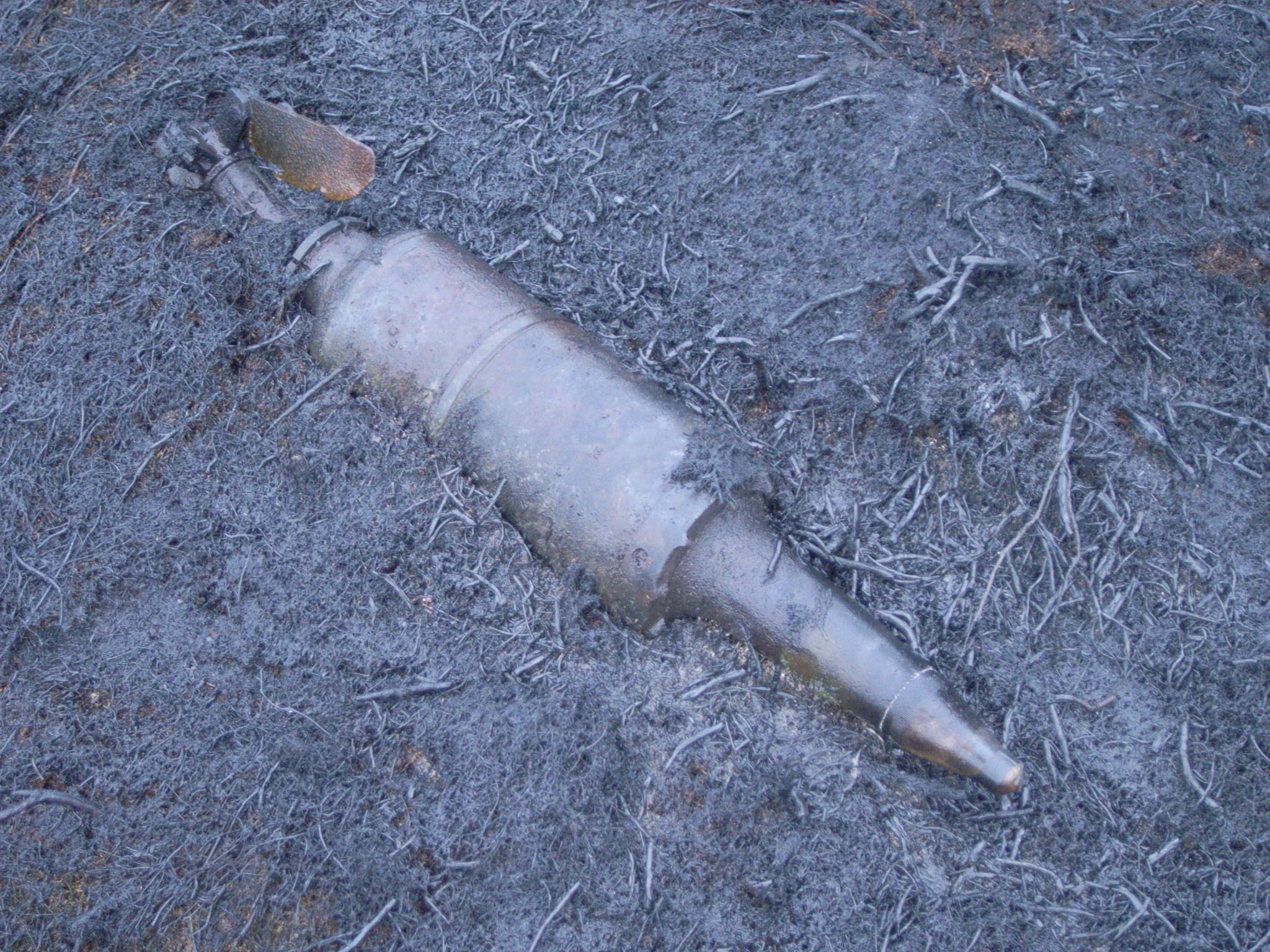
Fig. 14. Once unexploded ordnance has been exposed through controlled burning, it can be detonated on site or removed by Explosive Ordnance Disposal (EOD) teams.
International Cooperation
Federal and state authorities, as well as scientific institutions, collaborate at various levels—within the United Nations, multilateral organizations, and directly on a bilateral and cross-border basis. In the event of major wildfires, counties and federal states cooperate across state lines. Similarly, cross-border partnerships for firefighting are maintained along the borders with neighboring countries, for example along the Upper Rhine between Baden-Württemberg and France (Alsace), Brandenburg and Poland, or North Rhine-Westphalia and the Netherlands. Furthermore, Germany participates in the EU Civil Protection Mechanism.
At the international level, there are a number of bilateral and multilateral agreements on cooperation in the prevention and suppression of wildfires, for example among the member states of the Association of Southeast Asian Nations (ASEAN) or bilateral agreements between Australia, Canada, Mexico, New Zealand, South Africa, and the United States; the latter agreements are based, among other things, on the respective national implementation of the Incident Command System (ICS), which facilitates the exchange of certified experts between countries (GFMC).
Since 2024, the Federal Republic of Germany has been supporting the Global Fire Management Hub—established by the Food and Agriculture Organization (FAO) and the United Nations Environment Programme (UNEP)—and its International Interoperability Working Group. This working group provides advisory support to United Nations member states in further developing formal agreements on cooperation in fire management, including mutual assistance.
The GFMC, which operates worldwide across all continents through its nine regional centers at the Science-Policy-Practitioners Interface (SPPI), supports the establishment of the Global Fire Management Hub (GFMC). In this context, the work of the GFMC and the regional centers is focused less on informing the public and more on providing policy advice and supporting the implementation of capacity-building efforts in integrated fire management at the national and transboundary levels.
Federal and state government agencies, as well as scientific institutions, collaborate at various levels—within the United Nations, multilateral organizations, and directly through bilateral and cross-border partnerships.
United Nations
Following the establishment of the GFMC with funding from the Federal Foreign Office as Germany’s contribution to the United Nations (1998), the GFMC has been transitioning into the Global Fire Management Hub since 2023. Germany—represented by the Federal Ministry of Agriculture, Food, and Home Affairs (BMLEH)—has co-chaired the steering group of the “Fire Hub” together with the United Nations Environment Programme (UNEP) since 2026:
- Global Fire Management Hub
- Background Information—Germany’s Technical Cooperation with the FAO
- Fire Hub Working Group International Interoperability (co-chaired by GFMC)
The EU and Multilateral Organizations
As a member state of the EU, Germany participates in the Joint Civil Protection Mechanism:
As a member state of the Council of Europe, Germany operates one of the 22 specialized risk centers under the European and Mediterranean Major Hazards Agreement (EUR-OPA):
As a participating State in the Organization for Security and Cooperation in Europe (OSCE), Germany provides advisory capacities with a focus on cross-border confidence-building cooperation:
International Declarations
The Federal Government has signed the following international declarations, which are not legally binding under international law but represent a political declaration of intent
- UN General Assembly 78th Session, Resolution on Disaster Risk Reduction A/RES/78/152 (19.12.2023) and UN General Assembly 79th Session, Resolution on Disaster Risk Reduction A/RES/79/205 (21.12.2024)
- Group of Seven (G7) Kananaskis Wildfire Charter (17.6.2025)
- UNFCCC COP 30 Call to Action on Integrated Fire Management and Wildfire Resilience (Belém, Brasilien, Leaders’ Summit, 6.-7.11.2025)
- 7th United Nations Environment Assembly (UNEA-7)12.2025)
Contact and Copyright
Fire Ecology Research Group and Global Fire Monitoring Center (GFMC)
Author: Global Fire Monitoring Center (GFMC), Freiburg i.Br.
Images: Global Fire Monitoring Center (GFMC), Freibu i.Br.
Graphics and technical support: DKKV Secretariat and GFMC
Created: July 2026
Photo Gallery
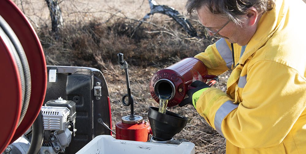
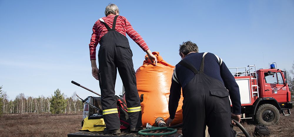
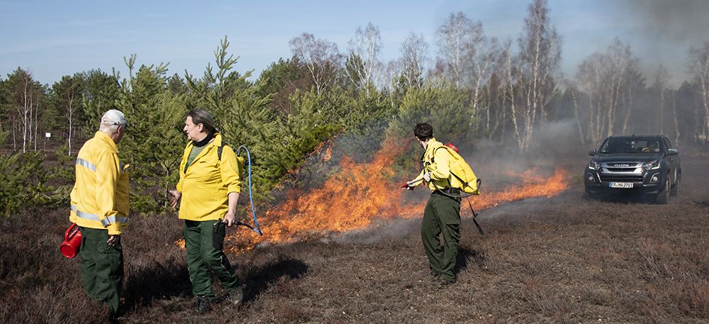
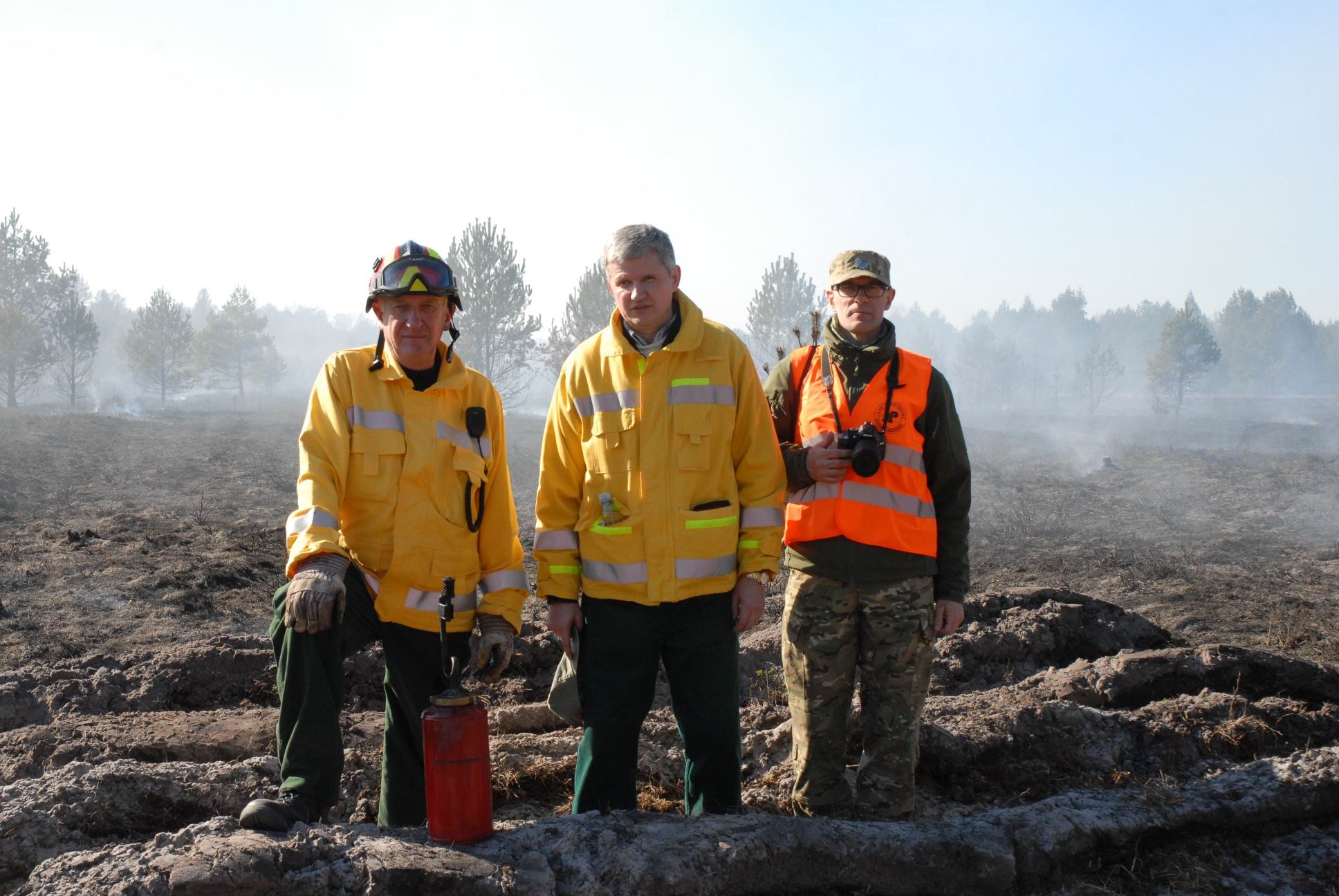
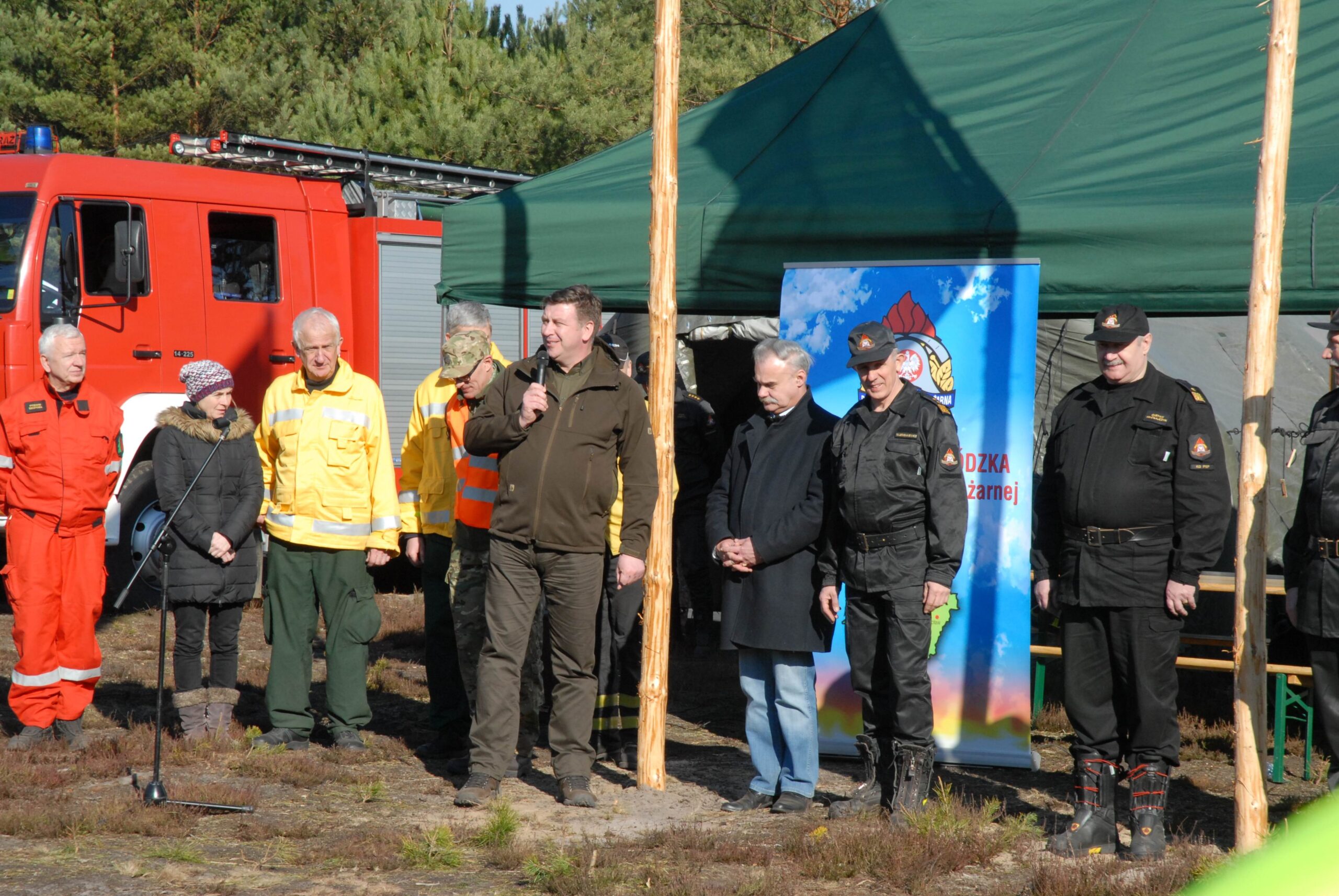
Further Information
Links
Publications
Goldammer (2013): Vegetation Fires and Global Change. Challenges for Concerted International Action. A White Paper directed to the United Nations and International Organizations.
Goldammer (2023): G20 Study on Restoration of Forest Fire impacted Areas for Recovering the Natural Biodiversity. Country Profiles – Germany (not published!)
Komac et al. (2020): Evolving Risk of Wildfires in Europe. The changing nature of wildfire risk call for a shift in policy focus from suppression to prevention.
Pasiecznik a. Goldammer (2022): Towards fire-smart landscapes. Tropical forest Issues 61.
Rossi et al. (2020): Evolving Risk of Wildfires in Europe. The changing nature of wildfire risk calls for a shift in policy focus from suppression to prevention
Current Information
No Results Found
The page you requested could not be found. Try refining your search, or use the navigation above to locate the post.