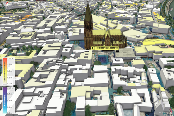
The Urban drainage companies in Cologne (StEB Köln), an institutional member of DKKV, has published a new generation of its heavy rain hazard maps, which show the city area interactively in 3D for the first time. Citizens can now see precisely what effects heavy rain can have in their area. The realistic representations are based on high-resolution hydrodynamic simulations and make flow movements, water levels and road conditions visible. The video function and aerial view make the course of a heavy rainfall event particularly clear. The free online application is aimed at anyone who wants to find out about local flood risks and suitable protective measures. The flood hazard maps have also been optimized.
You can read the entire report here.
(Image source: Steb-Köln)